


CLEVELAND — Stay alert this evening, overnight and through early Tuesday with a big round of storms expected to roll in from the northwest. Models are still struggling with timing, but it looks like there's a threat for strong to severe storms, possibly multiple rounds this evening and overnight that could produce wind damage.
Warnings and Watches
Warnings have been issued for the following counties until 12:45 a.m.:
- Summit County.
- Medina County.
- Wayne County.
- Holmes County.
- Stark County.
Watches have been issued for the following counties until 3 a.m.:
- Lorain County.
- Holmes County.
- Stark County.
- Medina County.
- Huron County.
- Portage County.
- Erie County.
- Richland County.
- Summit County.
- Ashland County.
- Wayne County.
A Flood Advisory has been issued until 3:15 a.m. for the following counties:
- Huron County.
- Wayne County.
- Ashland County.
- Stark County.
- Lorain County.
- Richland County.
- Holmes County.
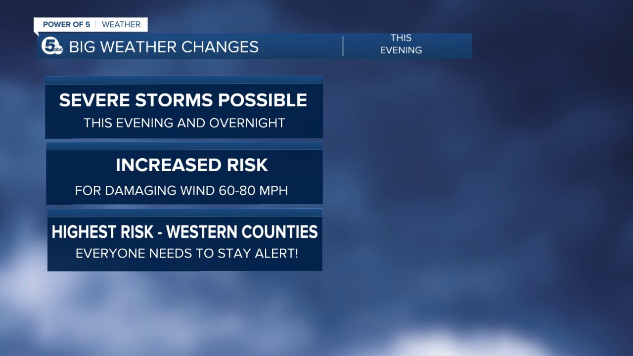
Be ready to take action if a warning is issued and make sure you have multiple ways to get warnings. A severe threat has been issued for Ashtabula but a slight risk is in place for Cleveland, Akron and much of the eastern half of the area. Highest threat for wind damage is in our western counties with an enhanced risk for severe storms from Sandusky to Mansfield.

All hazards are on the table tonight, with widespread damaging winds 60+ mph being the biggest threat. But flooding, hail, and a brief tornado can't be ruled out. Storms should fade mid-late morning Tuesday.

These storms will form along a warm front that will bring in a ton of heat by Wednesday. Am excessive heat watch has already been posted west of Cleveland that includes Toledo. Heat index values could climb to near 110 there! The most intense heat arrives in Northeast Ohio on Wednesday, so get ready for record high temperatures to be in jeopardy.

Temps in the 90s along with heat index values near 105 will impact your Wednesday outdoor plans. Be careful, stay hydrated and try to find the shade during the hottest part of the day. At least we are much cooler later in the week just in time for Father's Day weekend.
Download the News 5 app for the latest weather updates:
Follow the News 5 Weather Team:
Mark Johnson: Facebook & Twitter
Trent Magill: Facebook & Twitter
Remeisha Shade: Facebook & Twitter
Katie McGraw: Facebook & Twitter
