


Storms and heavy rain swept through Northeast Ohio Saturday evening, prompting several counties to be placed under watches and warnings.
As of Sunday at 11 a.m., all weather alerts have expired for News 5's viewing area.
Storms began to pop up Saturday afternoon, and most Northeast Ohio counties were placed under a Severe Thunderstorm Watch, which lasted until 9 p.m.
Some counties like Richland, Holmes, Ashland and Wayne were under Severe Thunderstorm Warnings throughout the evening on Saturday, with those warnings ending by 8:15 p.m.
Following the storms, Richland, Ashland and Holmes counties were placed under a Flood Warning until 11 a.m. Sunday.
The Power of 5 team monitored the storms and flooding throughout Saturday, and Meteorologist Phil Sakal was live, tracking some of the storms Saturday night:
Early Saturday
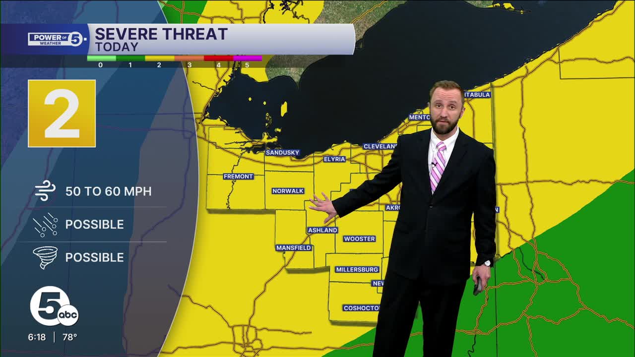
The young severe season continues to bring more opportunities for damaging storms. Another powerful cold front will trigger a few severe storms Saturday evening.
There will be plenty of fuel for storms to fire up this afternoon, with record warmth and higher humidity. 80s and humid weather will trigger a few pop-up downpours as soon as 3 p.m., with the severe threat increasing starting at 5 p.m. this evening.
The main threat with any severe storms that develop will be damaging gusts of 60 to 70+ miles per hour. There is also a stray chance for a tornado or two. While the threat is low, it is not zero, and, as with Tuesday's two confirmed tornadoes, it is important to have easy access to weather alerts, like in our News 5 app, with notifications turned on.
In addition to the severe threats, there is an even higher flood threat, especially after Friday evening's flooding. Adding more heavy rain on top of saturated ground and flooded roadways is a recipe for more flooding and potentially water rescues. Remember, turn around, don't drown if you see any standing water in front. Six inches is enough to stall a sedan.
Want the latest Power of 5 weather team updates wherever you go? Download the News 5 App free now: Apple|Android
Click here to view our interactive radar.
Follow the News 5 Weather Team:
Trent Magill: Facebook & Twitter
Katie McGraw: Facebook & Twitter
Phil Sakal: Facebook & Twitter
Allan Nosoff: Facebook & Twitter
