


CLEVELAND — The first round of storms for the season arrives Thursday, bringing rain and a threat of flooding to low-level areas.
Plan on light rain this morning. Just enough to make you run the wipers a few times. The next round will have more of an impact.

Plan on downpours and gusty winds embedded with lightning. Remember, if you're close enough to hear thunder, you're close enough to get struck by lightning.
This afternoon's biggest threat will be flooding. Heavy rain on an already soggy ground from the winter could really cause problems. Turn around, don't drown. Be sure to stay safe during our first storms of the season. After sunset, the cold front sags south.
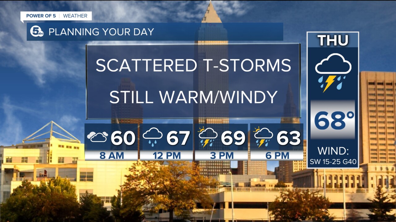
That means a few more storms could spark along the leading edge of the cold air. More downpours and gusty winds possible but should pass quickly. Cold air surging south will shut our rain down by midnight for most. And I mean cold... 30s tonight, back to near 50 degrees Friday afternoon and we don't make it out if the 30s Saturday.
Want the latest Power of 5 weather team updates wherever you go? Download the News 5 App free now: Apple|Android
Download the StormShield app for weather alerts on your iOS and Android device: Apple|Android
Click here to view our interactive radar.
Read and watch the latest Power of 5 forecast here.
Follow the News 5 Weather Team:
Mark Johnson: Facebook & Twitter
