

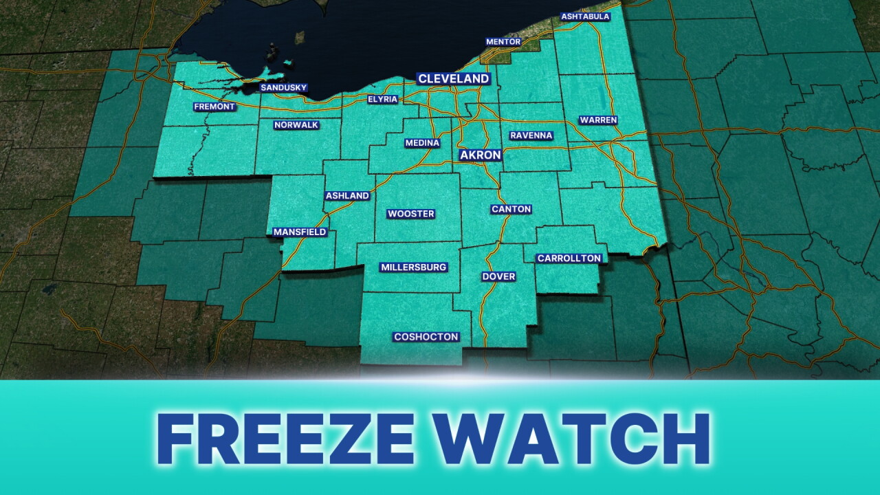


How the tables are turning ... weather-wise. It was 73 degrees at 6 a.m. Friday morning. There may be graupel (a type of frozen precipitation) by Friday night. Then, the first freeze of the season arrives for most on Saturday night.
Saturday morning will feature patchy frost for the South and Akron/Canton regions as cold air continues moving in. The coldest part of this pattern will be Saturday night, which is why the NWS has issued a FREEZE WATCH in advance of the sub-freezing temperatures for most of our Power of 5 regions. The Freeze Watch has been issued for all local counties except Lake and northern Ashtabula:
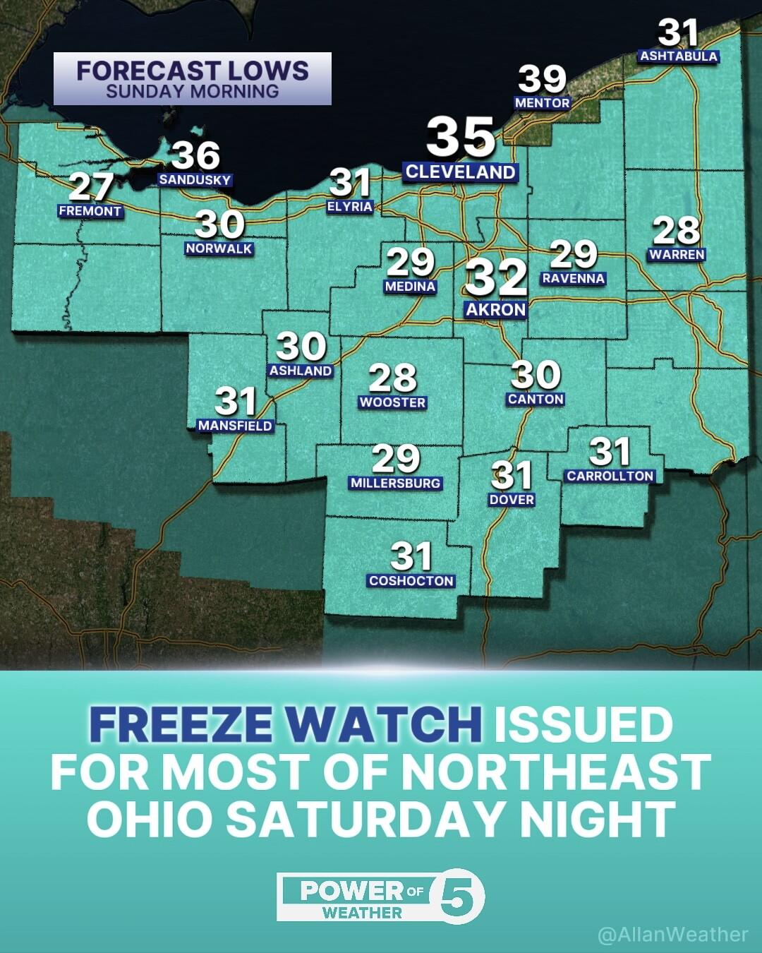
What is the difference between a Freeze WATCH and WARNING? Timing. A Freeze Watch is issued in advance of potential freeze conditions, 36 to 48 hours out. A Freeze Warning is then subsequently issued when freezing temperatures are expected within 24 hours. As of Friday afternoon, we are in the watch time frame.
While lakeside communities, mostly Lake and coastal Ashtabula counties, are not under the Freeze Watch, expect a FROST ADVISORY to be issued tomorrow within 24 hours, as some frost is expected, but not a freeze. Lows in towns like Chardon and Madison will be between 33 and 36 degrees, cold enough for frost, but warm enough to avoid a freeze.
Now is a good time to remind everyone to bring in your plants. Especially tropicals. They will not survive the freeze Saturday night.
Check out the forecast this morning from meteorologist Trent Magill.
Want the latest Power of 5 weather team updates wherever you go? Download the News 5 App free now: Apple|Android
Click here to view our interactive radar.
Follow the News 5 Weather Team:
Trent Magill: Facebook & Twitter
Katie McGraw: Facebook & Twitter
Phil Sakal: Facebook & Twitter
Allan Nosoff: Facebook & Twitter
