


It may be hard to believe, but severe storms are a growing possibility this weekend, even though it's just the start of March.
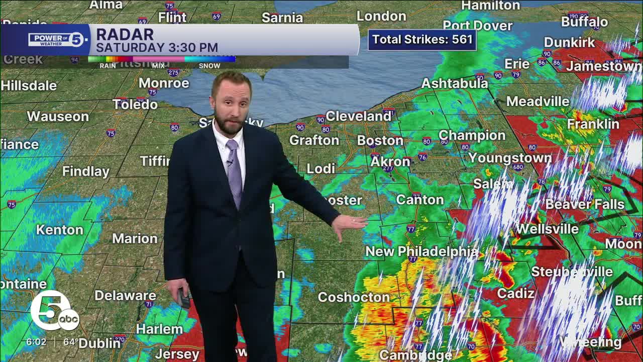
News 5 Meteorologist Allan Nosoff was live Saturday afternoon with updates:
A Tornado Watch was issued for several Northeast Ohio counties Saturday afternoon, but has since been cancelled.
A powerful cold front is expected to move through the area, bringing an increased chance of damaging gusts, flooding downpours, some small hail, and even a tornado threat.
The timing of these storms is critical to their severity and to which areas could see the greatest impacts. The earlier in the day the front crosses through, the less energy the storms will have, thus limiting the extent of severe storms on the west side. The green color for the severe threat map for areas like Sandusky and Norwalk shows a lower chance. There will still be downpours and some 40 to 60 mph gusts. The hail and tornado threat is near-zero there. The highest chance for severe storms would then be farther to the east, closer to the Pennsylvania state line, and to the south of Akron.
There is a LOT more fuel for the storms to feed on. That includes more sun and warmer temperatures. 60s and 70s this morning with high humidity is a recipe for storms to brew. Highs Saturday will be challenging records for the day. The latest update from the National Weather Service's Storm Prediction Center has areas from I-71 points east under a tier 2 tornado risk, where if a tornado forms, can be EF-2 or greater. This does NOT mean widespread tornados, but an elevated risk at one or two spinning up, especially in Stark, Tuscarawas, and Carroll counties.
What is the big takeaway? Plan on impacts and/or interruptions to Saturday plans, especially if they are outdoors. A line of storms is very likely at some point during the day. The timing is still unclear at this point, ranging from mid-morning to mid-afternoon. As it is only Thursday as of this article update, and there is still plenty of time to watch, it is important to check back here for critical timing updates that will play a big role in how strong Saturday's storms get.
Want the latest Power of 5 weather team updates wherever you go? Download the News 5 App free now: Apple|Android
Click here to view our interactive radar.
Follow the News 5 Weather Team:
Trent Magill: Facebook & Twitter
Katie McGraw: Facebook & Twitter
Phil Sakal: Facebook & Twitter
Allan Nosoff: Facebook & Twitter
