


CLEVELAND — Friday is going to be a BAD day for many across the Midwest and Mississippi Valley. A major Severe Weather Outbreak is forecast to for areas from Southern Wisconsin, south through Iowa, Illinois, Tennessee, Missouri and Arkansas. Intense and widespread severe thunderstorms will develop ahead of a strong low pressure and a cold front moving out of the Rocky Mountains on Friday afternoon. Damaging straight-line wind gusts could exceed 70 mph, especially across eastern Iowa and western Illinois. But what is more concerning: extremely large and long-lived tornadoes are possible as well, especially near the Missouri Bootheel, Western Tennessee and Northeast Missouri.

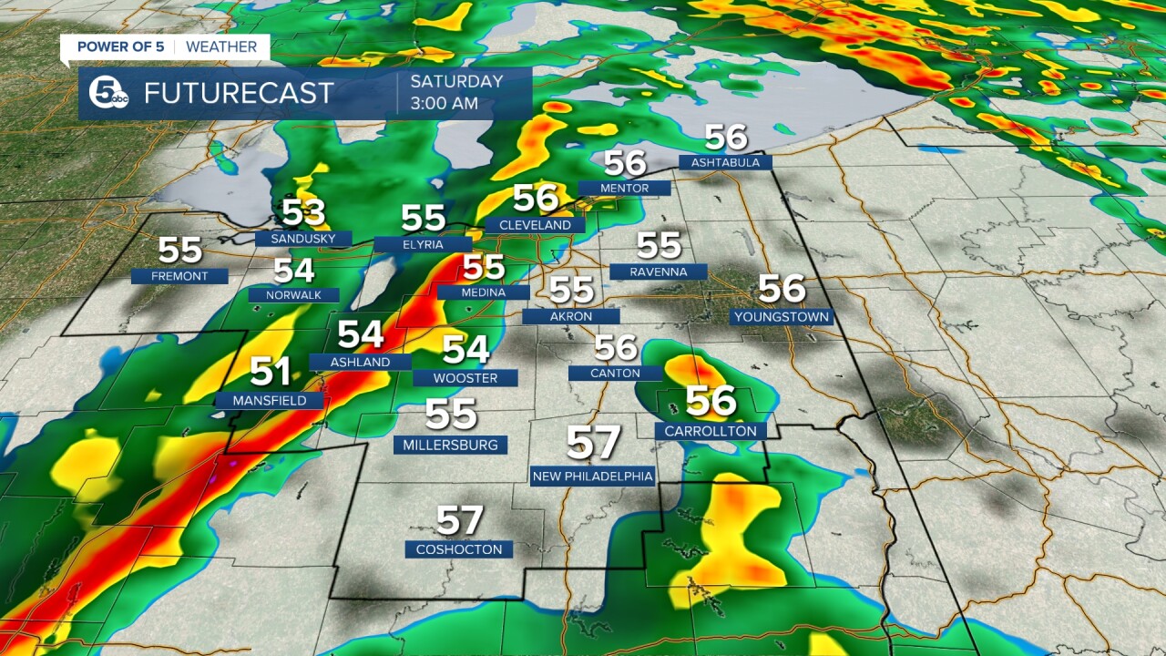
The severe weather threat will then shift east into Ohio on Friday night and into Saturday morning. The good news is the storms should drastically weaken by the time they reach us. Friday evening through early on Saturday (figure 10 pm - 6 am) a line of storms could produce isolated wind gusts close to 60 mph as they move through. The better chance is in western Ohio as storms will continue to weaken as they progress east. Be sure to have a way to get warnings overnight.

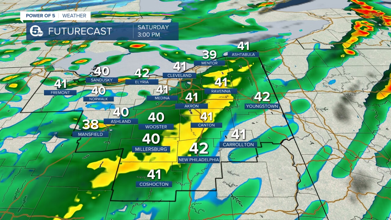
A Wind Advisory has been issued for nearly all of our counties from Saturday morning through Saturday evening for gusty non-thunderstorm winds as this massive storm system moves through the Great Lakes. Plan for southwest winds 20 to 30 mph with gusts up to 50 mph. It's a similar scenario to last Saturday (although winds do look to be weaker than last Saturday). Power outages would be possible along with some tree damage.

TIMING: Winds will be increasing throughout the day with milder temperatures and scattered showers. After the sun goes down, there could be strong or severe storms that could produce damage. This risk continues into early on Saturday (before sunrise). Conditions will be briefly calmer and drier for a few hours during the morning, but gusty winds and strong storms return during the afternoon. Showers will come to an end by Saturday evening and into the second half of the weekend. Scroll through the images of Futurecast below to get an idea about timing of storms for both Friday night and Saturday.
Stay safe and stay connected with the Power of 5 Weather Team.


Want the latest Power of 5 weather team updates wherever you go? Download the News 5 App free now: Apple|Android
Download the StormShield app for weather alerts on your iOS and Android device: Apple|Android
Click here to view our interactive radar.
Read and watch the latest Power of 5 forecast here.
Follow the News 5 Weather Team:
Mark Johnson: Facebook & Twitter
Trent Magill: Facebook & Twitter
