


CLEVELAND — It looks like it will be a wild week of weather for Cleveland and the rest of Northeast Ohio.
We are kicking off the week with warm and steamy weather Monday with temperatures running about 10-12 degrees above the norm. The average high for this time of year is 75 degrees and we should soar to 86 this afternoon.

More clouds and rain will keep our temperatures lower Tuesday, in the 70s.
An even bigger temperature drop will arrive Wednesday behind a strong cold front with highs only in the 60s. Coolest weather is expected Thursday night when we likely dip to the 40s. So get the fall jackets ready!
Speaking of fall, the new season is set to officially arrive at 3:21 pm Wednesday; much cooler air will coincide with the start of autumn. This is also when day and night are around equal length.

RELATED: Why is there not equal day and night on the equinox?
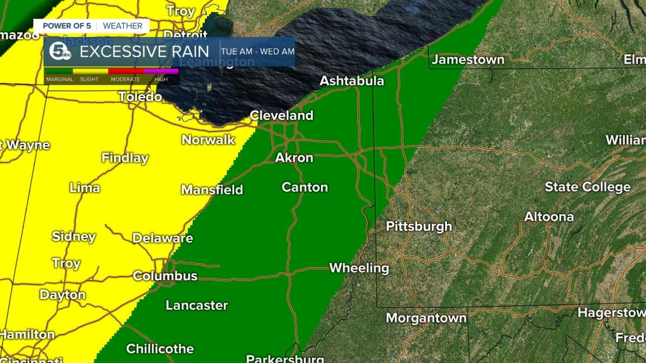
Widespread rain and the threat for flooding will also be with us Tuesday and Wednesday. Showers pick up especially the second half of Tuesday with rounds of heavy rain likely Tuesday night through Wednesday night. Rain even lingers for the first half of Thursday before we dry things out.

Models are indicating that our flood threat will be higher with 2-4" of rain a good bet for much of the area between Tuesday and late Wednesday.
Get the rain gear ready and be prepared to deal with some flooded streets. Remember to avoid driving across any flooded roads and always find an alternate route. At least at this point, it's looking pleasant and dry for the next big Browns home game this Sunday as they take on the Bears.
Want the latest Power of 5 weather team updates wherever you go? Download the News 5 App free now: Apple|Android
Download the StormShield app for weather alerts on your iOS and Android device: Apple|Android
Click here to view our interactive radar.
Read and watch the latest Power of 5 forecast here.
Follow the News 5 Weather Team:
Mark Johnson: Facebook & Twitter
Remeisha Shade: Facebook & Twitter
Trent Magill: Facebook & Twitter
Katie McGraw: Facebook & Twitter
