


CLEVELAND — Enjoy the gorgeous weather Thursday—it is fleeting! A strong system out to our west will slide toward Northeast Ohio over the next day. This will bring the return of showers and storms on Friday. Some of the storms could be strong to severe. All of NE Ohio is under a severe weather risk from the Storm Prediction Center for Friday and early Saturday.

SEVERE WEATHER RISK
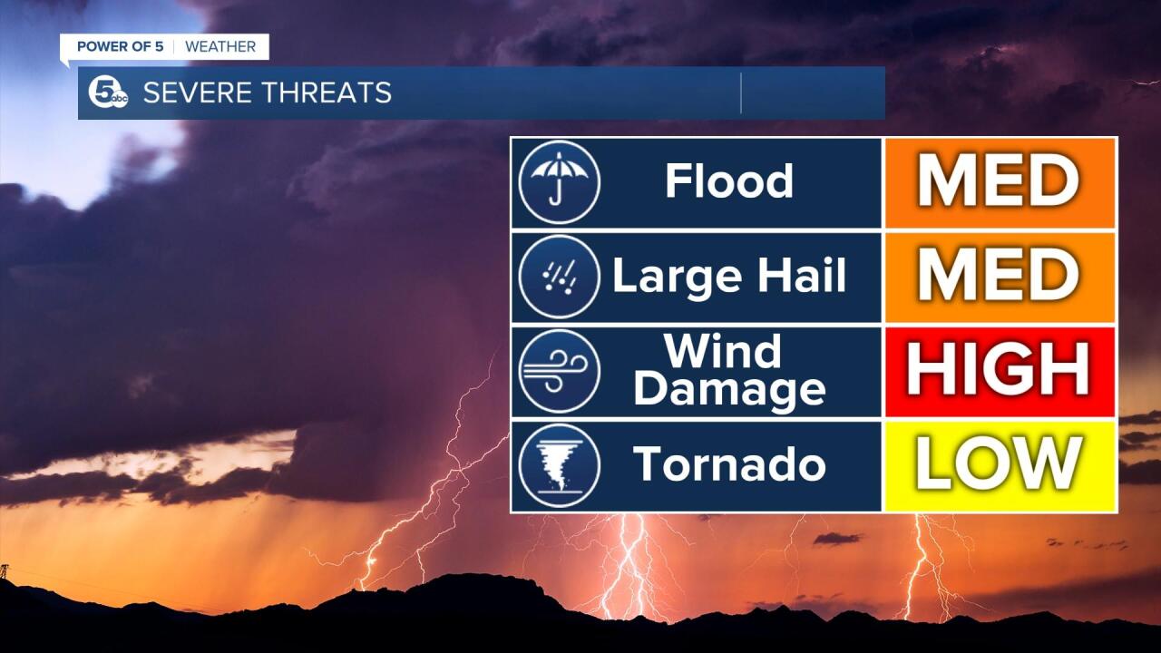
An enhanced risk (area in orange) has been posted for more than half of the News 5 viewing area. That is a level 3/5 and numerous severe storms are possible with varying levels of intensity. The area in yellow is a slight risk of severe weather and is a level 2/5. We will be watching for strong damaging wind gusts, hail, frequent lightning and an isolated tornado. Pockets of heavy rain could also lead to flooding and rising of creeks & streams.
SET UP
A strong system to our west will move toward the Great Lakes over the next 24-hours. It will lift a warm front northward. This will boost up our temperatures and dew points (moisture). Temperatures will be back in the 80s today and tomorrow. Dew points will climb back into the 60s by Friday. An increase of warmth and moisture will in turn increase instability and the potential for severe weather. There will also be plenty of wind energy throughout our atmosphere tomorrow.

TIMING:
The best chance for severe weather will be during the afternoon and evening tomorrow. It appears there will be two main waves of activity. By tomorrow morning, the radar will be active with showers and storms. The first wave should wrap up by mid-day. How the first round plays out; will impact the second round. The second wave of storms is expected during the late afternoon and lingers into Friday night/Saturday morning. Scroll through the images of futurecast below to get an idea about timing and coverage of storms on Friday. Be sure to keep up with the Power of 5 Weather Team. We will be monitoring the threat of severe weather over the next day.


