

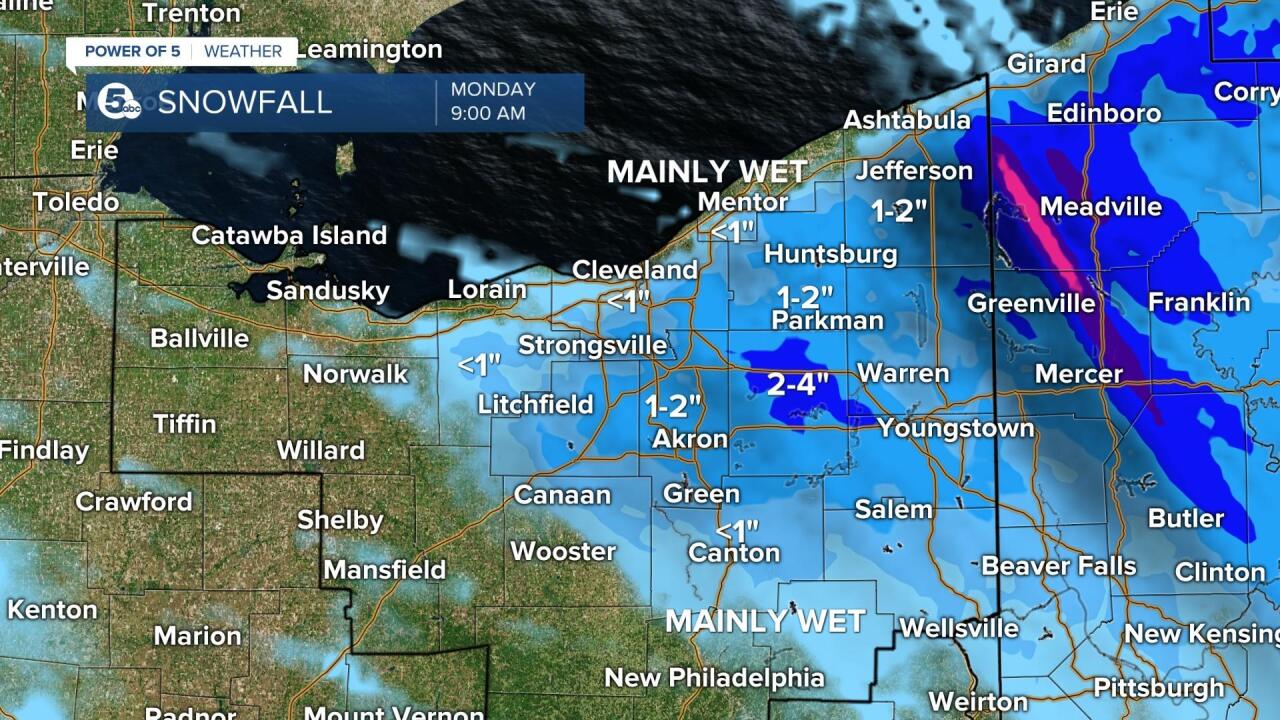
CLEVELAND — The first snowflakes of the season will fly as early as Sunday afternoon for some parts of Northeast Ohio.
On Sunday morning, wind and rain will be in the forecast, but Lake Effect snow is expected to make its way in by the afternoon.
Scattered snow showers are expected throughout Geauga, Ashtabula and parts of Cuyahoga County. Some areas in Medina, Lorain, Summit, Portage and Trumbull counties may see some snow their way as well.
Luckily, the ground and the roads are still warm, so the snow should melt on contact. However, it may be cold enough Sunday night for a few spots in Geauga, Ashtabula and Cuyahoga counties to have some slushy accumulation by sunrise.
For the most part, any snow accumulation on Sunday should be contained to grassy surfaces, trees, windshields, outdoor furniture and rooftops.
Click here to view our interactive radar.
Read and watch the latest Power of 5 forecast here.
Download the News 5 app for more weather information from the Power of 5 weather team: Apple|Android
Download the StormShield app for weather alerts on your iOS and Android device: Apple|Android
Follow the News 5 Weather Team:
Mark Johnson: Facebook & Twitter
Bryan Shaw: Facebook & Twitter
