


Temperatures have been well below average for days and days now, but there has been no real threat of record-breaking cold— until now.
Records are going to be tested across Northeast Ohio Friday and Saturday morning. Ties will be possible, but also outright breaking records is on the table, especially on Saturday morning.
Here's a look at the records for Friday morning:

Cleveland has had this record for over 150 years, and there's a chance for at least a tie!
Here's the forecast for low temperatures across Northeast Ohio Thursday night and Friday morning:

Akron-Canton could break its record, but Mansfield looks safe from breaking or tying.
This will change once we head into Friday night and Saturday morning. Winds will be light to calm, and skies will become clearer, not a recipe for keeping any warmth at the surface, especially with a fairly fresh snow pack.
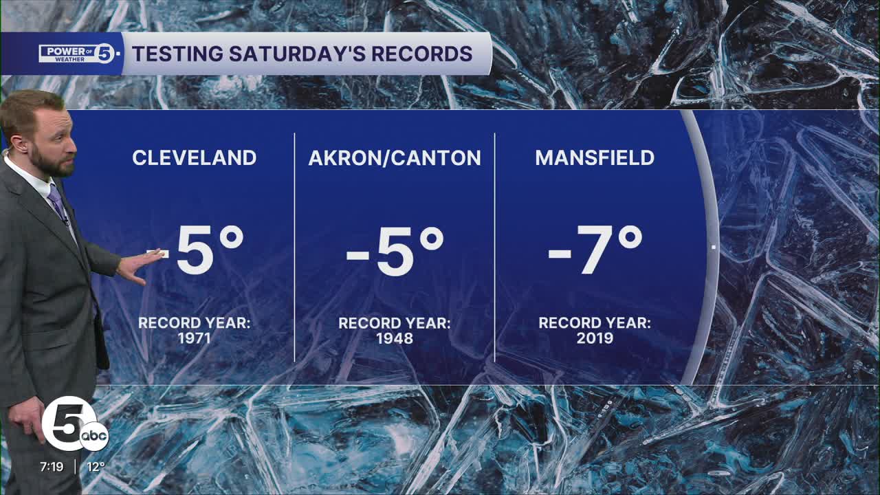
Here's a look at Saturday's records:

With the aforementioned clearing, calming winds and snow pack, temperatures are going to plummet Friday night into Saturday morning.
Friday Night/Saturday Morning Temperature Forecast:

This will possibly be the coldest morning in years for most of Northeast Ohio regarding actual air temperatures! Thankfully, the winds will be light or calm, because it would be much worse with wind chills.
So bundle up, drip the faucets and stay safe, Northeast Ohio!
Want the latest Power of 5 weather team updates wherever you go? Download the News 5 App free now: Apple|Android
Click here to view our interactive radar.
Follow the News 5 Weather Team:
Trent Magill: Facebook & Twitter
Katie McGraw: Facebook & Twitter
Phil Sakal: Facebook & Twitter
Allan Nosoff: Facebook & Twitter
