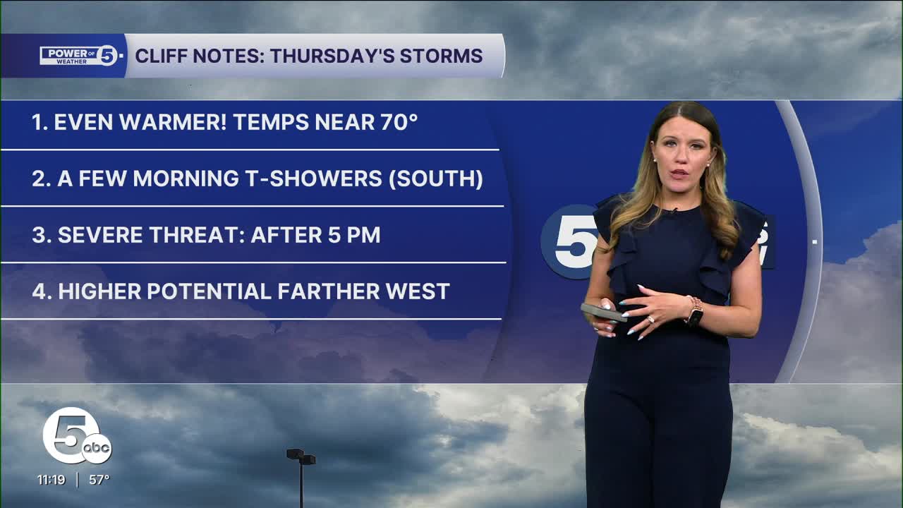


Another round of strong to severe storms is a possibility across Northeast Ohio on Thursday.
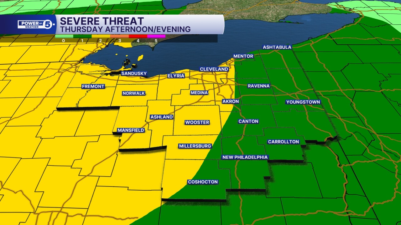
Most of our region west of I-77 is under a slight risk, a 2 out of 5 on the severe storm scale. East of I-77 is a marginal, or a 1 out of 5 on the severe storm scale.
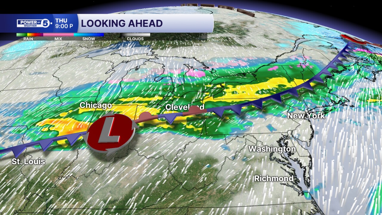
Timing on this threat will be late afternoon into the overnight, as a cold front moves through from the northwest to southeast.
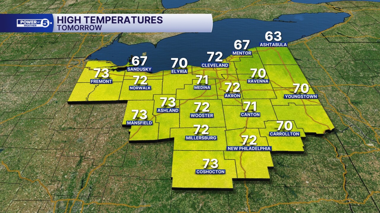
Out, ahead of the front, temperatures will soar once again, with many areas into the 70s for daytime highs Thursday afternoon.
The cold front will begin to move into the region during the mid to late afternoon.

It will bring storm chances at the end of the afternoon into the evening hours along the boundary.
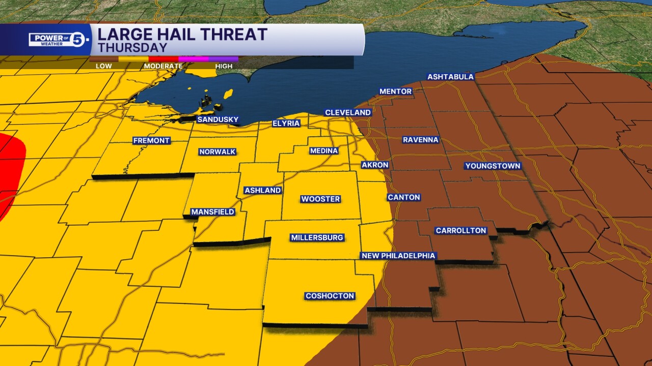
Highest potential for any severe storms will be in the areas west of I-77. Here's a breakdown of damaging wind, large hail and tornado potential for Northeast Ohio.
Damaging winds (60 mph or stronger):

Large hail (quarter-sized or larger):
Tornado:

The severe threat will be dying down during the second half of the overnight, as colder air moves back into the region for Friday.
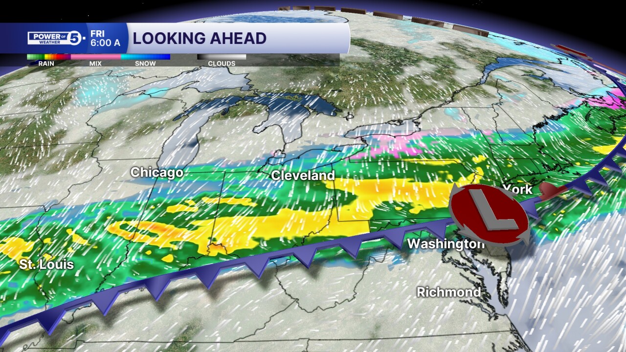
Rain chances will linger into the first half of the morning, especially in our southern communities on Friday. With even a few areas seeing a few flakes mixing in before noon on Friday, with temperatures in the 30s most of the day to end the work week.
Want the latest Power of 5 weather team updates wherever you go? Download the News 5 App free now: Apple|Android
Click here to view our interactive radar.
Follow the News 5 Weather Team:
Trent Magill: Facebook & Twitter
Katie McGraw: Facebook & Twitter
Phil Sakal: Facebook & Twitter
Allan Nosoff: Facebook & Twitter
