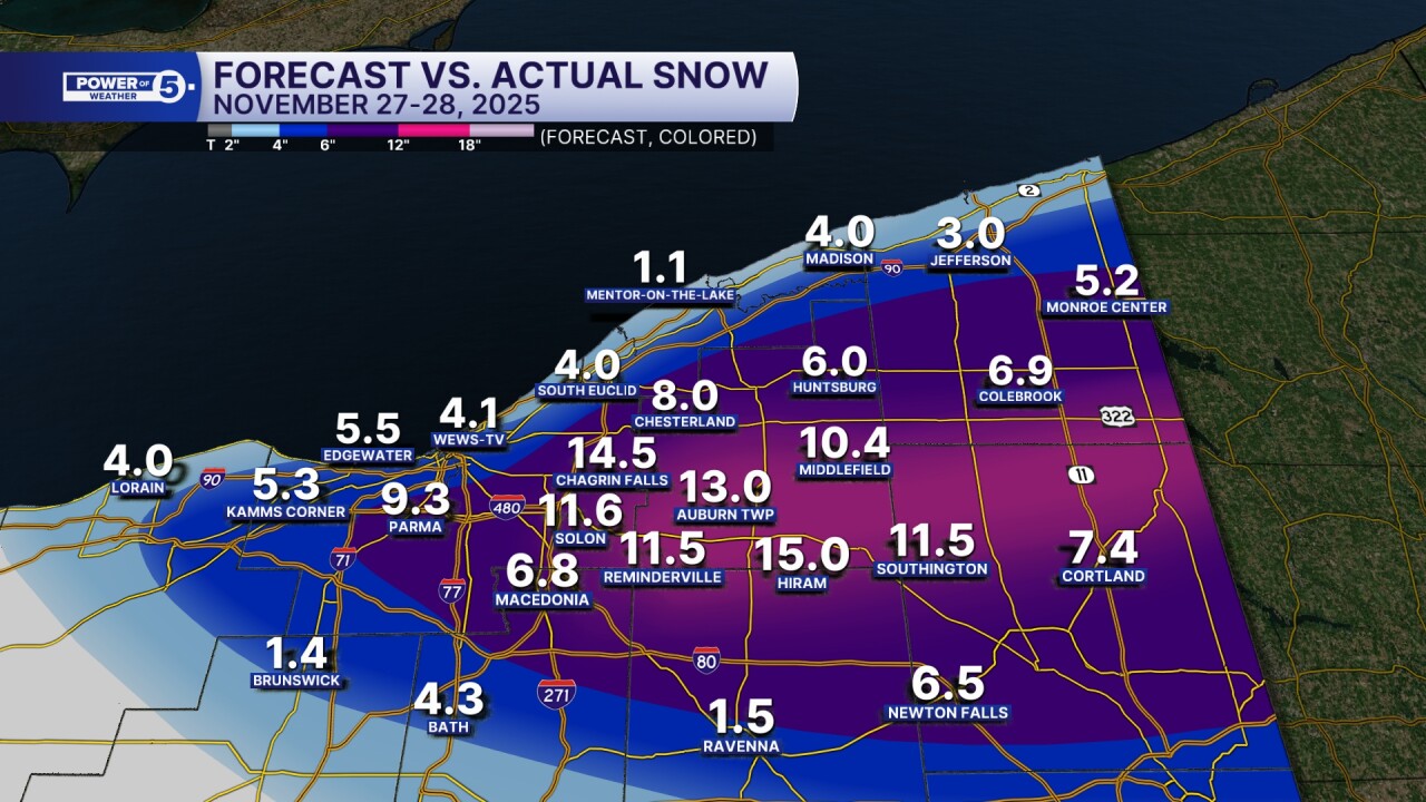
The final totals are in. So, how did the Power of 5 team do? Take a look at how close our forecast is to the actual totals with this very complex lake effect snow forecast.

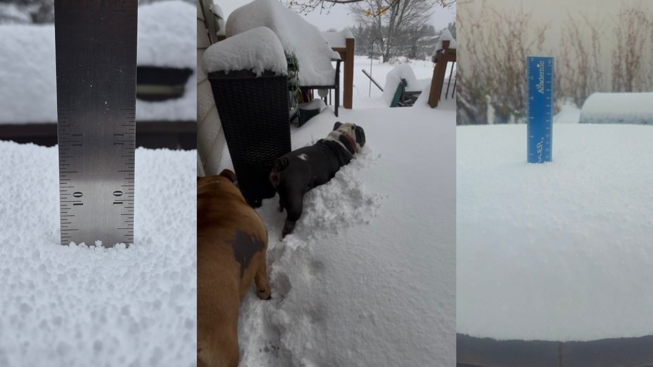
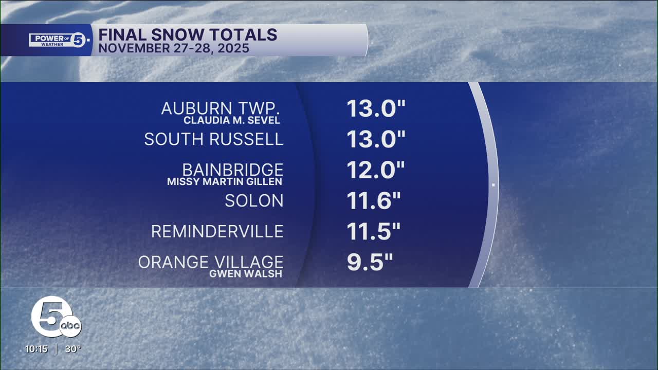
Even some of our News 5 viewers contributed via social media and email to deliver these helpful snow reports:


If you notice closely on the map, a mere 10 miles or less separates double-digit totals from just a couple of inches. That is the nature of lake-effect t bands, and one of the reasons why it is very difficult to have an accurate forecast.
Was it a perfect forecast? No. Southern Cuyahoga and Medina counties missed out on the band juuust to their northeast & got lower totals than predicted. The Power of 5 correctly predicted the Southern Geauga bullseye, as well as the notably lower totals along the immediate lakeshore.
Want even more totals? Take a look at the complete list below. Foot-plus totals are in bold:
Cuyahoga County
- Chagrin Falls 14.5"
- Solon 11.6"
- Orange Village 9.5" (Gwen Walsh)
- Parma 9.3"
- Edgewater 5.5" (Meteorologist Allan Nosoff)
- Kamms Corner 5.3"
- Parma Heights 4.4"
- Midtown Cleveland 4.1" (outside WEWS-TV's studios)
- North Olmsted 2.0"
Geauga County
- Auburn Corners 13.0"
- Auburn Township 13.0" (Claudia M. Sevel)
- Bainbridge 12.0" (Missy Martin Gillen)
- Middlefield 10.4"
- Chesterland 8.0" (Kim Welch)
- Huntsburg 6.0"
Medina County
- Brunswick 1.4"
Portage County
- Hiram 15.0"
- Aurora (north side) 12.0"
- Windham 3.2"
- Ravenna 1.5"
Stark County
- Canton 1.0"

Make sure you follow the Power of 5 team on social media as this is just the start of winter weather across Northeast Ohio, and it is important to stay safe and prepared. Links are below.
Want the latest Power of 5 weather team updates wherever you go? Download the News 5 App free now: Apple|Android
Click here to view our interactive radar.
Follow the News 5 Weather Team:
Trent Magill: Facebook & Twitter
Katie McGraw: Facebook & Twitter
Phil Sakal: Facebook & Twitter
Allan Nosoff: Facebook & Twitter


