Coming on the heels of last week's significant lake effect snow and Saturday night's wintry mix, more lake effect is expected Sunday evening ahead of a sizable coastal storm that could bring several inches of snow to many across Northeast Ohio.
A strong west wind and much colder air behind a cold front are expected to produce scattered lake effect snow showers, with the best chance between 4 p.m. and 10 p.m. this evening. It will be nowhere near as intense as last Thursday and Friday's lake effect, but it will likely be enough to cause travel trouble. Especially focusing on the busy I-90 corridor from the east side of Cleveland to the PA state line.
An inch or two of snowfall is expected in spots just inland and near the primary snow belt. Otherwise, it will be very cold for everyone tonight with wind chills in the teens and low 20s.
All attention then turns to Monday night and Tuesday as a stronger storm is expected to develop as it becomes a coastal storm on Tuesday. Parts of New England could experience significant snowfall, but before it reaches the coast, Northeast Ohio will be on the northwest side of the storm.
This article will be updated with National Weather Service alerts when they are issued, so bookmark this link.
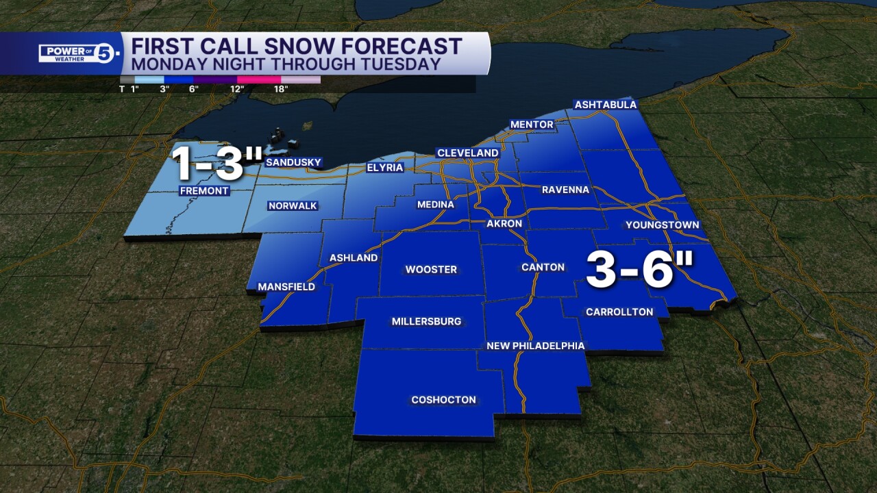
Snow is expected to develop from west to east through Monday evening, reaching everyone in the viewing area by about midnight. Snow will be light at first and intensify to a steady, if not moderate clip by the Tuesday morning commute. This will be a light and fluffy snow that easily stacks. The "ratio" or "fluff factor" will be high, so even though there isn't as much moisture on the northwest side of the storm, the light and fluffy snow will stack up higher than a wet and heavy snow.
The Tuesday morning commute is expected to be impacted by the moderate snow, especially closer to the storm. That is why areas south and east of Akron, areas closer to the storm center, will see heavier snow and higher snow totals.
Most areas as of Sunday morning could see three or four inches of snow, but the potential is there for up to six inches if bands set up and the storm tracks closer. The best chance for six inches will be in areas like Tuscarawas and Carroll counties.
Stay tuned and follow along for Power of 5 updates.
Want the latest Power of 5 weather team updates wherever you go? Download the News 5 App free now: Apple|Android
Click here to view our interactive radar.
Follow the News 5 Weather Team:
Trent Magill: Facebook & Twitter
Katie McGraw: Facebook & Twitter
Phil Sakal: Facebook & Twitter
Allan Nosoff: Facebook & Twitter


