


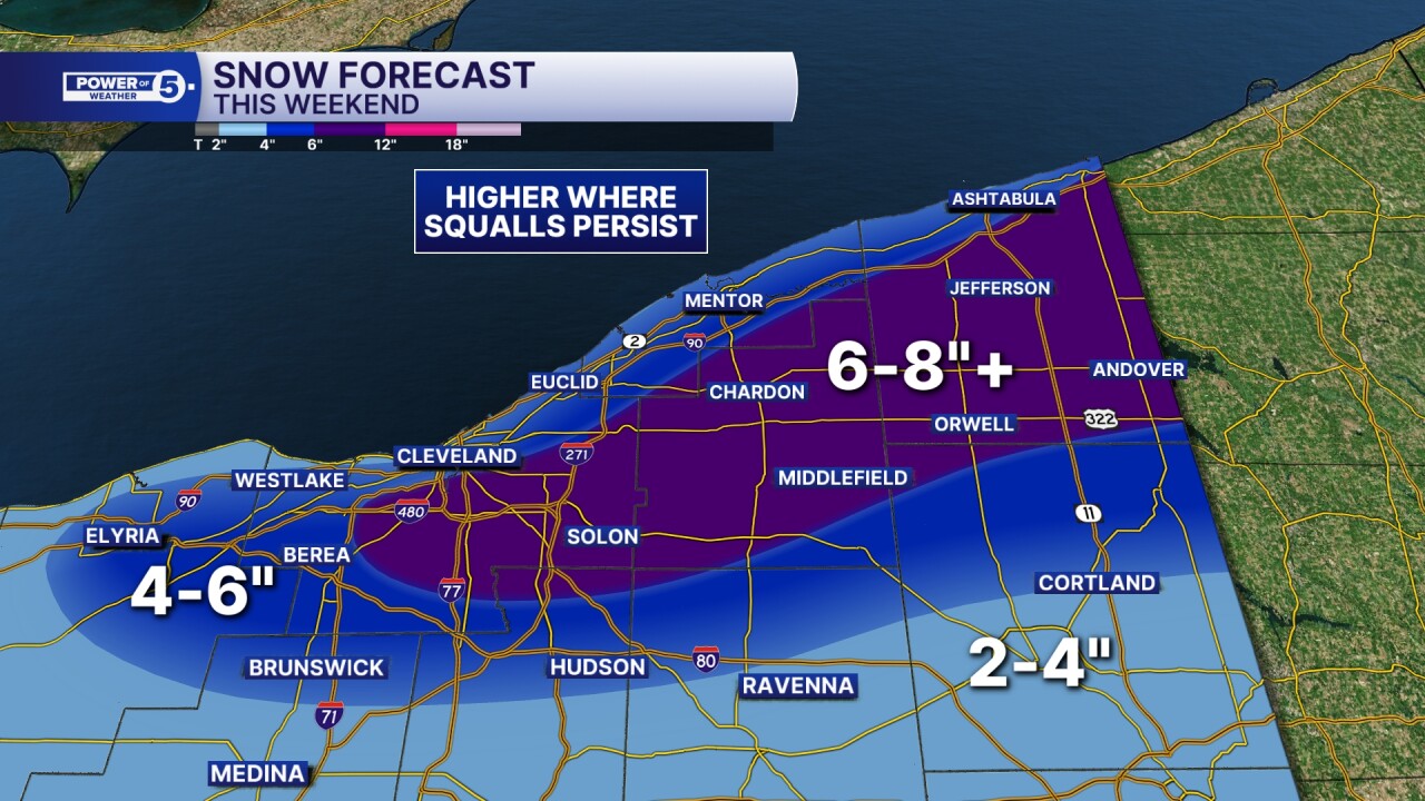
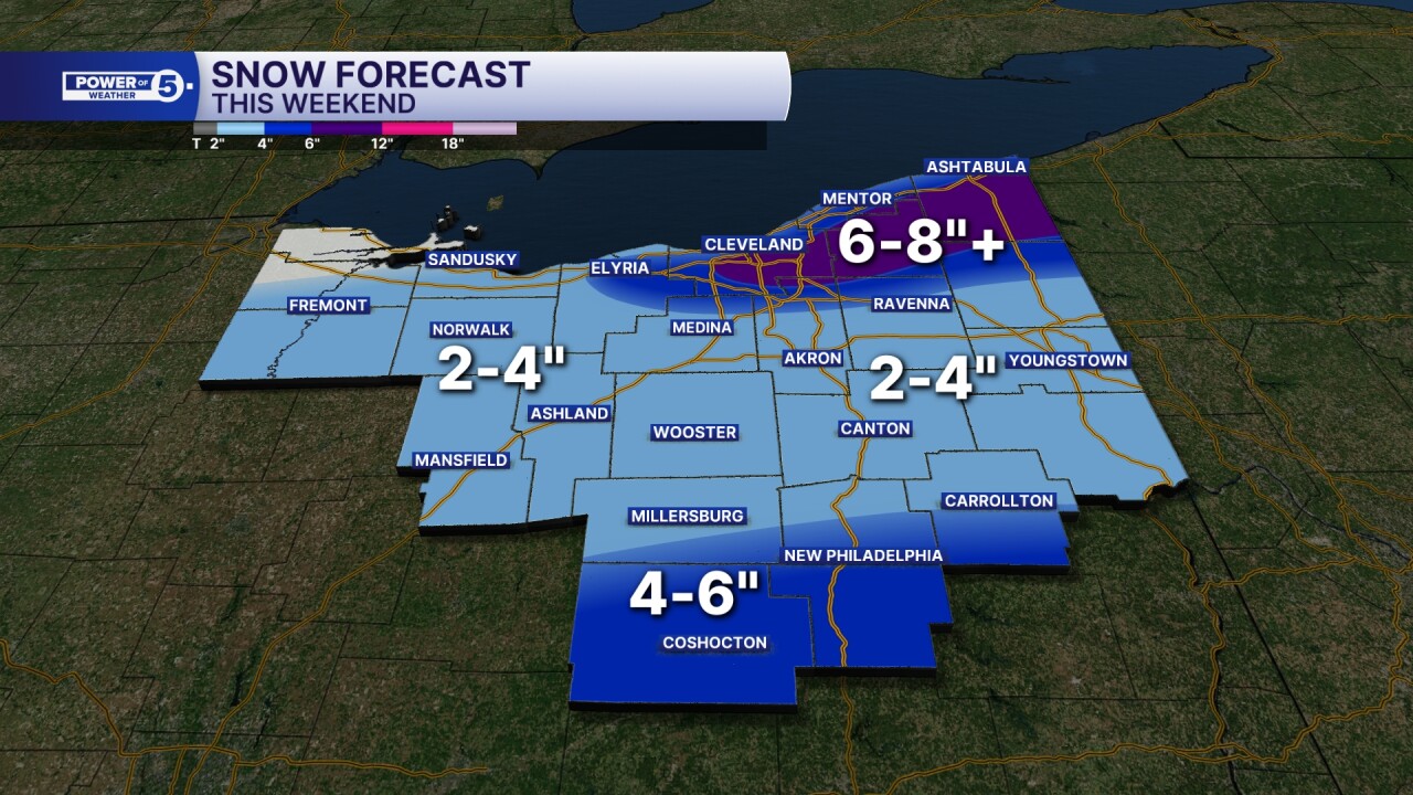
Impactful snow hit Northeast Ohio this weekend with a trifecta of systems: an arctic cold front, a clipper, and lake effect snow.
The Power of 5 gave updates on the latest snowfall and temperatures on Sunday afternoon.
WATCH BELOW:
Lake Effect Snow Warnings and Winter Weather Advisories were in place for most of the weekend for the snowbelt.
Counties under a Snow Emergency are:
- Lorain is under a Level 1 Snow Emergency as of 5:55 p.m. on Saturday.
- Summit is under a Level 1 Snow Emergency as of 11:25 a.m. on Sunday.
- Portage is under a Level 2 Snow Emergency as of 1:50 p.m. on Sunday.
Counties under a Winter Weather Advisory are:
- Lorain, Medina, Summit and Portage from 1 p.m. through 7 a.m. Monday.
Parking Bans:
- Rocky River has declared a citywide parking ban as of 7 p.m. on Saturday. Officials said the restriction is intended to allow the city's service department to clear roadways safely.
Lake effect snow will continue into Monday morning. It has impacted the primary and secondary snowbelts throughout the weekend. This will bring more significant snow to the snowbelt region, where 4" to 6"+ will be possible Sunday.
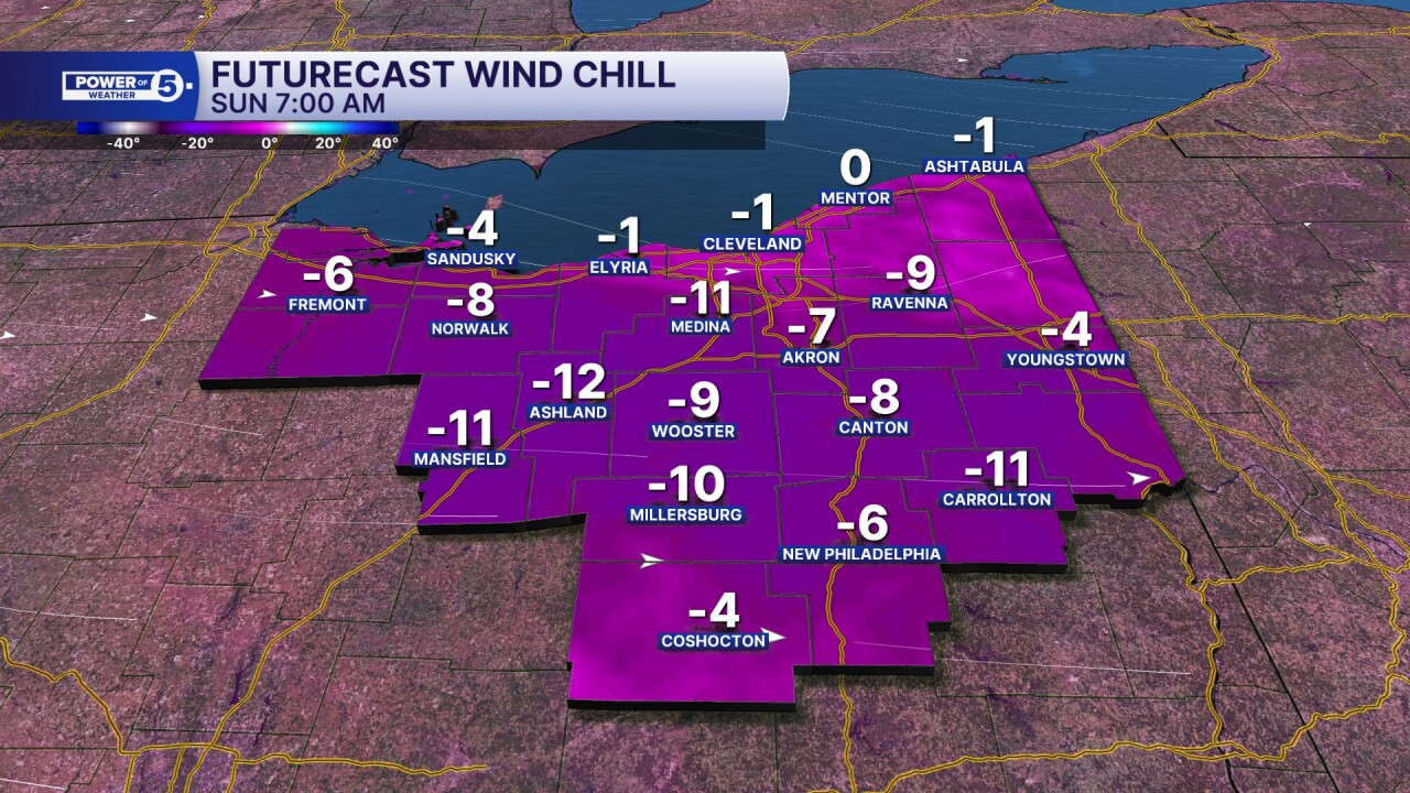
The snow wasn't the only problem across NEO this weekend, as arctic air moved in Sunday morning, bringing below-zero chills in many locations.
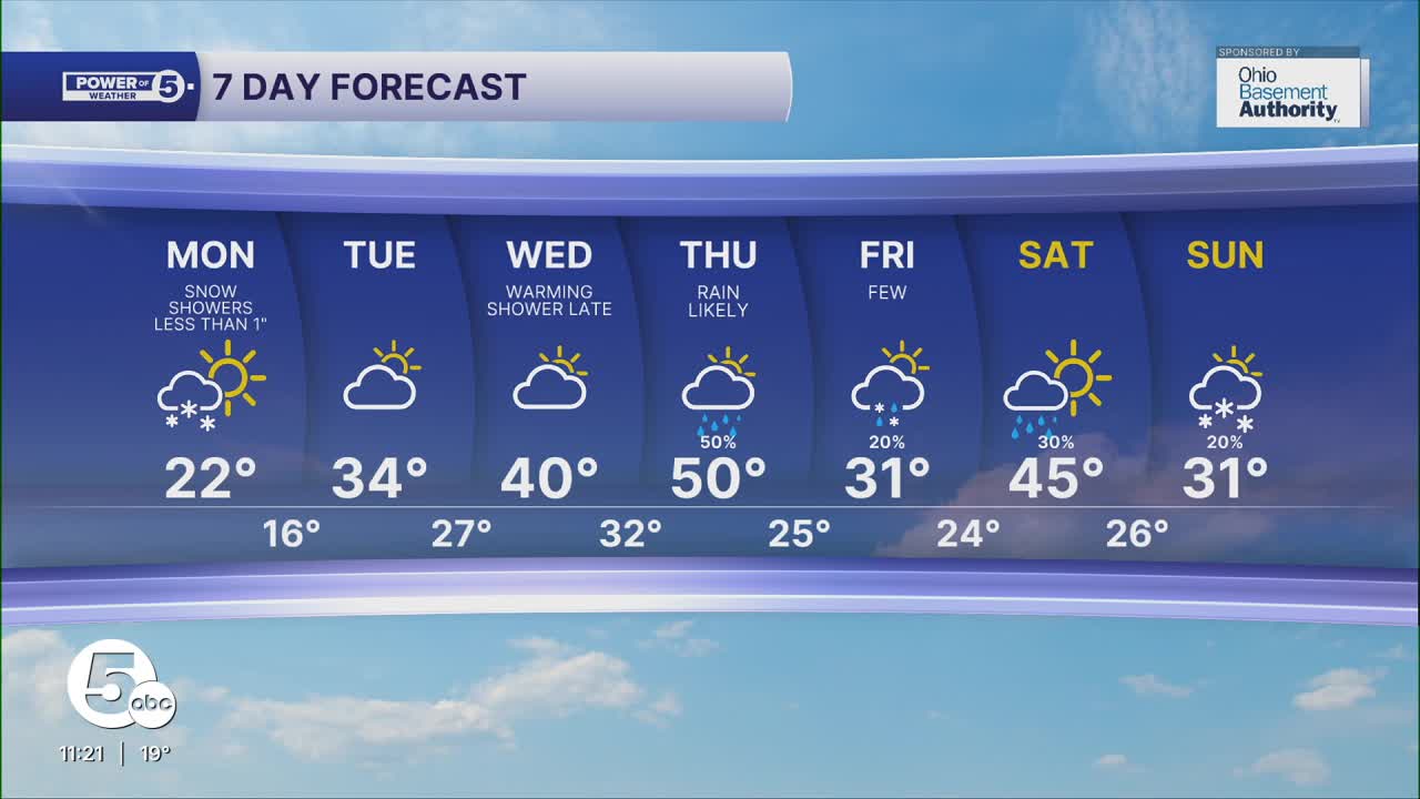
After this weekend, temperatures will slowly warm as we begin the new work week, with highs nearing 32° by Tuesday.
Want the latest Power of 5 weather team updates wherever you go? Download the News 5 App free now: Apple|Android
Click here to view our interactive radar.
Follow the News 5 Weather Team:
Trent Magill: Facebook & Twitter
Katie McGraw: Facebook & Twitter
Phil Sakal: Facebook & Twitter
Allan Nosoff: Facebook & Twitter
