


The National Weather Service is surveying damage across Ohio on Thursday following severe weather on Wednesday. These survey teams are looking at the storm damage to determine if a tornado caused it and, if so, how strong of a tornado it was when it occurred, etc.
PORTAGE COUNTY: The NWS in Cleveland confirmed damage from an EF 1 tornado occurred Wednesday evening near Windham in Portage County. The tornado had estimated wind speeds of 110 mph and was on the ground for nearly 4 miles with a path width of 65 yards. It started WSW of Windam at 6:45 pm and ended NNE of Windham at 6:51 p.m.

The tornado began near the intersection of State Route 303 and Stanley Road. The tornado produced wind damage of EF-0 to low-end EF-1 intensity as it downed trees and damaged the roofs of several buildings. The tornado continued northeast toward Bryant Road, where the tornado caused significant damage to a large garage and moved a shed several yards, in addition to downing several trees. The tornado crossed the Ohio Turnpike, impacting three tractor-trailers and closing the highway for some time. North of the Ohio Turnpike and off Bryant Road, the tornado heavily damaged a mobile home, flipped over a car and boat, and caused other minor structural damage indicative of EF-1 damage. The tornado continued northeast toward Parkman Road, Crestview Drive, Wisteria Street, and Geneva Drive. This area received the greatest wind damage from the tornado, indicative of the 110 mph rating. Several homes were heavily damaged, with a loss of roofing material, siding, and blown-out windows. Two homes were shifted off their foundations. Numerous large trees were downed onto some homes. The tornado continued northeast and crossed State Route 82, west of Horn Road, where several trees were snapped. The tornado continued producing tree damage to Frazier Road before dissipating prior to reaching Silica Sand Road. Thankfully, there were no reports of injuries or fatalities.


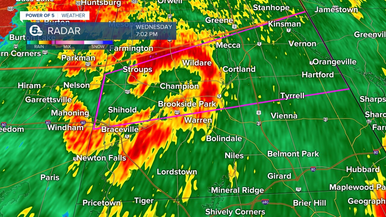
TRUMBULL COUNTY: The NWS in Cleveland confirmed damage from an EF 0 tornado occurred Wednesday evening near Champion Township and Southington Township in Trumbull County. The tornado had estimated wind speeds of 80 mph and was on the ground for nearly three miles with a path width of 20 yards. It started west of Champion Heights at 7:01 p.m. and ended NNW of Champion Heights at 7:06 p.m.

The tornado touched down near State Route 305, east of Hoffman Norton Road. Damage in this location included significant damage to a garage and some downed trees, and roofing damage, indicative of 80 mph winds. The tornado continued northeast to Oak Hill Drive, where additional downed trees caused damage to a couple of homes. The tornado continued northeast to Downs Road NW, where more trees prompted more home damage. The tornado caused more tree damage west of Mahoning Avenue (State Route 45), but the tornado likely dissipated prior to reaching the road. Thankfully, there were no reports of injuries or fatalities.

CRAWFORD COUNTY: The NWS in Cleveland confirmed damage from an EF 1 tornado that occurred Wednesday near Bucyrus in Crawford County. This is just outside of the Power of 5 viewing area to the west of Richland County. The tornado had estimated wind speeds of 110 mph and was on the ground for nearly 3 and a half miles with a path width of 100 yards. It started WSW of Bucyrus at 4:06 pm and ended NE of Bucyrus at 4:11 p.m.

The tornado began near the bend of Kerstetter Road and West Southern Avenue. The tornado yielded 80 mph winds with damage to the roof of a home on West Southern Avenue. The tornado tracked northeast and produced scattered damage in the form of broken tree limbs. The tornado continued northeast across the Sandusky River and increased in intensity up to 100 mph. Several large hardwood trees were uprooted, a garage was destroyed, a small trailer rolled, three chimneys were blown down, several large trees were uprooted, and a shed was destroyed near the intersection of Ridge Avenue and Wise Street. The tornado continued northeast with max winds of 110 mph while moving a house off its foundation. The tornado also caused roof damage to the post office and a roof collapse at a convenience store in and around downtown Bucyrus. In addition, an abandoned plant wall was blown out and several antennas were bent. The tornado continued northeast, blowing down several large trees across a golf course and damaging a storage shed. Several tree limbs were broken as the tornado tracked northeast and weakened. The tornado finally ended along Beechgrove Road northeast of U.S. Highway 30.


There were also other tornadoes reported in Ohio. The NWS in Wilmington confirmed an EF-0 touched down in eastern Champaign County and an EF-1 in SE Delaware County.
EF Scale: The Enhanced Fujita Scale classifies tornadoes into the following categories:
- EF0.....65 to 85 mph
- EF1.....86 to 110 mph
- EF2.....111 to 135 mph
- EF3.....136 to 165 mph
- EF4.....166 to 200 mph
Want the latest Power of 5 weather team updates wherever you go? Download the News 5 App free now: Apple|Android
Download the StormShield app for weather alerts on your iOS and Android device: Apple|Android
Click here to view our interactive radar.
Read and watch the latest Power of 5 forecast here.
Follow the News 5 Weather Team:
Mark Johnson: Facebook & Twitter
Trent Magill: Facebook & Twitter
