


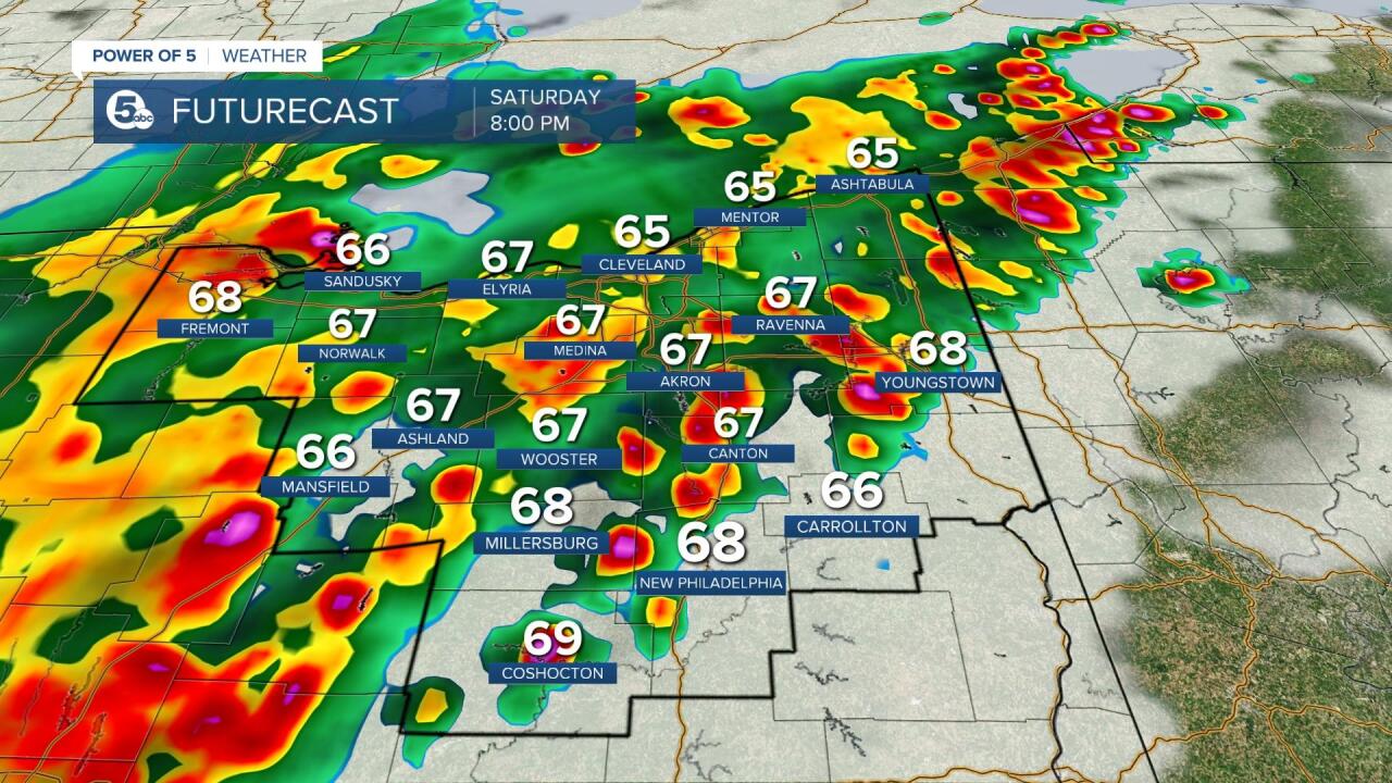
CLEVELAND — Strong to severe storms will be possible Saturday afternoon through Saturday night.
News 5 Meteorologist Remeisha Shade has the lastest in the player below:
ALERTS/WATCHES/WARNINGS
A Severe Thunderstorm Watch has been issued for most of Northeast Ohio until 10 p.m. Winds of 60 mph or greater are possible. Heavy rain could lead to flooding.
A Flood Advisory is in effect for the following counties until 10 p.m.
- Ashtabula
- Cuyahoga
- Geauga
- Lake
CLICK HERE For News 5's Weather Alert page.
Thousands of customers are currently without power across Northeast Ohio. CLICK HERE to check power outages in your area.
Viewer video
The video below shows hail in Huron County. Courtesy of Alphabet Marketing, LLC.
SEVERE POTENTIAL:
The Storm Prediction Center upgraded and expanded the risk for severe weather across Northeast Ohio on Friday. Most of the area is in the 2/5 risk level. This is known as a slight risk for severe weather and means that scattered severe storms are expected in the yellow area. The area in green is a marginal risk for severe weather and is a level 1/5. This shows there is a better chance to experience severe weather in our northern and western communities, but the entire viewing area has the potential for severe weather.
The main threats for severe weather on Saturday will be damaging straight line winds and large hail. However, tornadoes are not off the table either. Additionally, heavy rain that could lead to localized flooding and lightning are also likely.

TIMING:
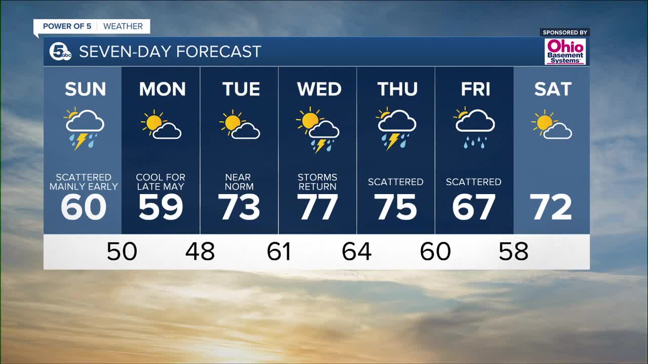
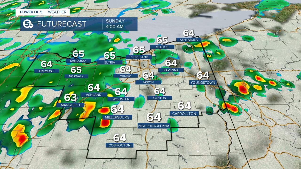
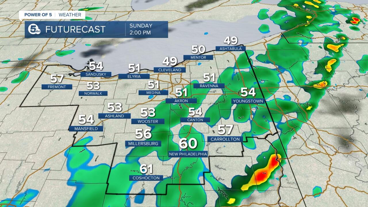
Strong to severe storms will be most likely from 3 - 9 p.m. with storms fading around midnight. Scattered thundershowers are likely overnight and into Sunday morning. NE Ohio will gradually dry out on Sunday, but temperatures will be falling! Sunday afternoon will likely be in the 50s!
Today is a day to be weather aware! Strong to severe storms can produce damaging winds, hail or tornadoes. Be sure to check in with the Power of 5 Weather Team all weekend long and have a way to receive warnings if and when storms become severe. You can also check back to this article. We will continue to update this information throughout the day.

Want the latest Power of 5 weather team updates wherever you go? Download the News 5 App free now: Apple|Android
Download the StormShield app for weather alerts on your iOS and Android device: Apple|Android
Click here to view our interactive radar.
Read and watch the latest Power of 5 forecast here.
Follow the News 5 Weather Team:
Mark Johnson: Facebook & Twitter
Remeisha Shade: Facebook & Twitter
