


The strongest solar storm in over 20 years continues, and a major boost on Wednesday afternoon could elevate this aurora experience to once-in-a-lifetime.
Here is the breakdown — an X-5.1 flare from the sun has slammed into Earth around 1:30 p.m. local time Wednesday, the strongest Earth-directed flare since Halloween 2003, if not longer. This comes on the heels of two separate solar flares that produced aurora as far south as Mexico on Tuesday night. Combine these three flares, and their impact could yield even brighter colors in the sky. Why is it not a slam dunk, though? Space science is a lot more complicated.
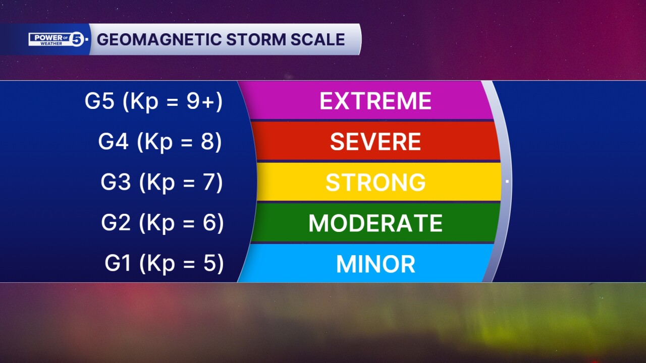
In order to even have a chance to see the northern lights, there are three keys that must be in place. Clouds block the aurora, so Tuesday night's cloudy sky prevented most of Northeast Ohio from seeing it. A full moon is very bright, and oftentimes mutes the colors of the aurora to the point where it is not visible. And the intensity of the solar storm itself usually has to be a G3 or greater, on a G1 to G5 scale.

Tuesday night's storm was a G4, and very close to being a G5, but low clouds blocked most of Ohio's aurora opportunity then. Clouds are expected to slowly depart Wednesday evening, from west to east, so areas like Ashland, Mansfield, and Sandusky have a higher chance of seeing the northern lights before anyone else across the area.
The forecast remains a G4 with potential upgrade to G5, which was last achieved in May 2024. The moon is in third quarter and is not a full moon. The clouds remain the biggest factor in viewing the likely lights.
To ensure the best chance of seeing them, wait at least 30 to 45 minutes after sunset so that any sunlight does not mute the aurora. Look north with little obstruction from buildings or terrain. Open your smartphone camera and use the "night mode" in the camera app, which allows the camera lens to capture more light than the human eye, and capture more color from the aurora.
We want to see YOUR aurora pictures, and show them to our viewers — please send your photos to 5pix@wews.com and you may see them on-air and/or on our social media.
Want the latest Power of 5 weather team updates wherever you go? Download the News 5 App free now: Apple|Android
Click here to view our interactive radar.
Follow the News 5 Weather Team:
Trent Magill: Facebook & Twitter
Katie McGraw: Facebook & Twitter
Phil Sakal: Facebook & Twitter
Allan Nosoff: Facebook & Twitter
