


CLEVELAND — It's going to be another hot and humid day Tuesday.
The Power of 5 Weather Team isn't expecting much activity on the radar in the morning. There's a slim shot at an isolated shower or storm.
Scattered storms expected to develop this afternoon, especially after 2 p.m. The main window for storms will be from 2-8 p.m. and there could be a storm that briefly turns severe although widespread severe weather is not expected. Heavy rain will provide relief from the 90-degree heat for some.
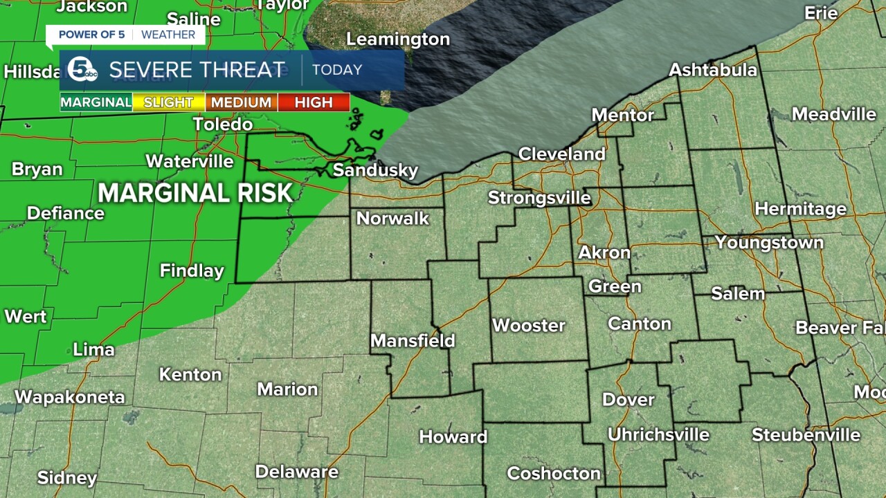
A few storms could be strong and an isolated severe storm can't be ruled out, especially Northwest near Sandusky.
Temperatures climb to around 90 degrees today with lots of humidity.
Watches, Warnings and Advisories
A Severe Thunderstorm Warning is in effect for Portage and Trumbull counties until 7:45 p.m.
According to the National Weather Service, minor damage to vehicles is possible. You should also expect damage to trees and power lines.
Want the latest Power of 5 weather team updates wherever you go? Download the News 5 App free now: Apple|Android
Download the StormShield app for weather alerts on your iOS and Android device: Apple|Android
Click here to view our interactive radar.
Read and watch the latest Power of 5 forecast here.
Follow the News 5 Weather Team:
Mark Johnson: Facebook & Twitter
Remeisha Shade: Facebook & Twitter
