

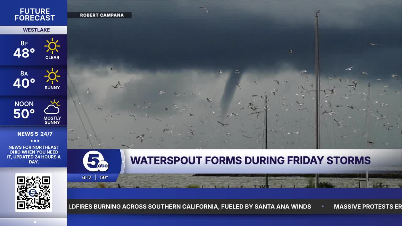



LORAIN COUNTY, Ohio — Thanks to multiple News 5 viewers sending photos of waterspouts off the coast of Lorain County Friday afternoon, there were at least three confirmed waterspouts.
At 5:47 p.m. Friday evening, one of the waterspouts seen by viewers in Lakeview Park may have briefly become a tornado as it survived the transition from water to land.
After communicating with the National Weather Service, they could not confirm it was a tornado, but Richard Garuckas said a tornado was "most likely was the culprit though."
A Special Marine Warning was issued just moments after the first waterspout reports came in, around 5:45 p.m., with the cold air boundary moving through, also producing thunderstorms and over 40 mile per hour gusts. The waterspouts that formed along this cold air boundary are known as 'cold air waterspouts' which form by the dynamic difference between the warm and moist air ahead of the sharply colder and drier air behind the boundary, responsible for Saturday night's frost and freeze.
If there was a tornado, it was down for only a few seconds. Damage reports were "isolated" according to Chief of Police Andrew Kory, including a tripped transformer, fallen tree debris, and property damage.
Betty Dittmer, who lives along Idlewood Avenue just a couple of blocks from the lakefront, saw significant damage sustained to her property. Her daughter was driving on the highway nearby and was on the phone with her mother saying she saw a funnel cloud. They did not realize that storm, which was a confirmed waterspout, was the same storm that would cause damage to her home.
Dittmer said it, "sounded like a freight train," with the rain and wind picking up from nothing to intense in just seconds.
Damage was sustained to parts of their home, backyard, and outdoor furniture. Some of their furniture ended up several homes away, and their backyard ended up with foreign furniture as well.
I also spoke with nearby neighbor Stacy Francis, who heard the sudden burst of wind, as well as damage sustained to her home and property. Francis said it picked up from a calm and ominous sky one minute to a powerful gust of wind in a matter of seconds, and believes she saw rotation in the clouds close to the ground for a split second.
At the end of the day, whether a tornado is ever confirmed or not, based on the images sent in to News 5 and the description of the storm, it could have been a tornado briefly causing the damage before lifting several blocks inland. The National Weather Service concluded that "a classic cold air waterspout over the lake moved onshore before dissipating... there was shallow rotation and there was also social media video of a waterspout offshore of Lorain County. We sent out a report for some damage related to wind but haven't officially confirmed it was from a waterspout reaching shore yet. Most likely was the culprit though."
If you saw any damage or have any photos of the waterspout and/or possible tornado, please submit them to 5pix@wews.com.
Want the latest Power of 5 weather team updates wherever you go? Download the News 5 App free now: Apple|Android
Click here to view our interactive radar.
Follow the News 5 Weather Team:
Trent Magill: Facebook & Twitter
Katie McGraw: Facebook & Twitter
Phil Sakal: Facebook & Twitter
Allan Nosoff: Facebook & Twitter
