

CLEVELAND — All of Northern Ohio is under a COLD WEATHER ADVISORY for the rest of Monday and through midday Tuesday. The coldest air of the season is on the way overnight. What does this relatively new "Cold Weather Advisory" entail?
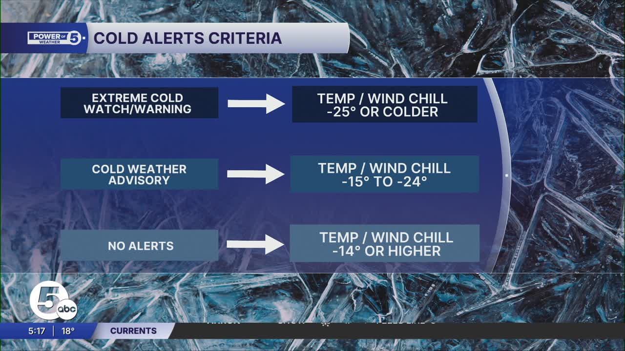
This is only the second winter that these cold-weather alerts have been in use. The reason for the change is to remove confusion in the messaging from the National Weather Service, and therefore from our Power of 5 team to you, the viewer (and reader). The previous alerts were not as consistent or as clear for the general public. The new alerts are simpler, with clear definitions for what the wind chill temperature must drop to for each alert.
As the Power of 5 team has been calling for the last several days, wind chill (or feels-like) temperatures will drop to between 15 and 20 below zero. That is into the -15 to -24-degree zone for a COLD WEATHER ADVISORY. It is dangerously cold, where unprotected skin could experience frostbite within just a couple of minutes.
Northeast Ohio has seen even colder weather than what we're expecting into Tuesday morning. Wind chills can drop to -30 degrees, even -40 in the most extreme circumstances. When that happens, an EXTREME COLD WARNING is issued. As the name implies, that is extreme cold. Not ruling that out later in the year, but that level of cold is not expected overnight.
One more note — our phone weather apps have not been properly equipped to display these alerts, so on some iPhones it is showing as "Severe Weather Advisory", which is inaccurate. This is one more reason to use the News 5 app that properly displays these new alerts.
Want the latest Power of 5 weather team updates wherever you go? Download the News 5 App free now: Apple|Android
Click here to view our interactive radar.
Follow the News 5 Weather Team:
Trent Magill: Facebook & Twitter
Katie McGraw: Facebook & Twitter
Phil Sakal: Facebook & Twitter
Allan Nosoff: Facebook & Twitter
