


CLEVELAND — The final weekend of 2025 is upon us, and so far it has been cold, cloudy and quiet. That is going to change, and it will be a very bumpy ride to end the year!
A warm front moves in on Sunday morning, and an initial burst of moderate rain is expected during the early morning. Most likely between 6 and 8 a.m. Sunday.


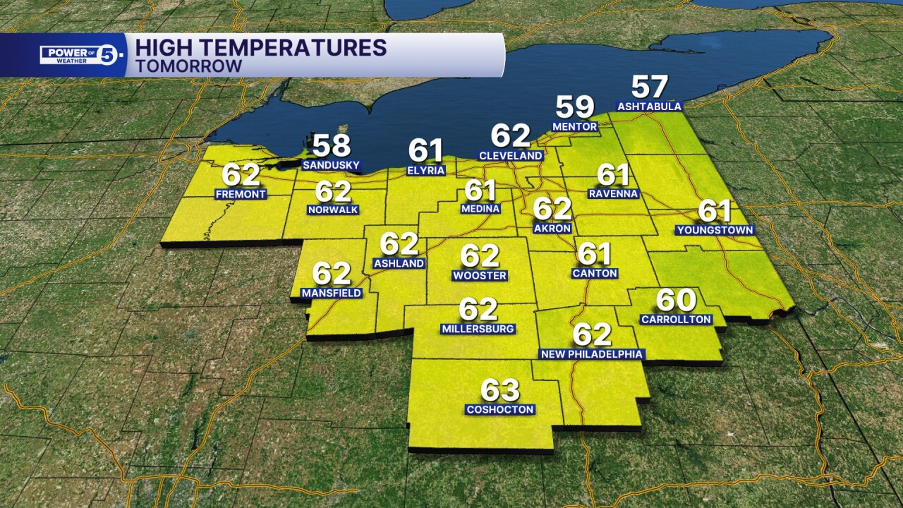
Temperatures will then soar into the 50s and 60s Sunday afternoon, along with increasing winds out of the south.
Most of the heavy rain will likely stay north over the lake, but occasional isolated downpours are possible the rest of the day, especially north of Akron, which means some rain is likely for the Browns game.


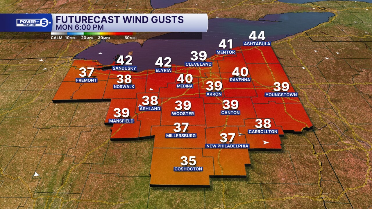
By the end of the afternoon and into the evening, winds will intensify as a cold front moves closer to Ohio from the west. By the end of the evening, wind gusts of 40 to 50+ mph will become more widespread across Northeast Ohio.

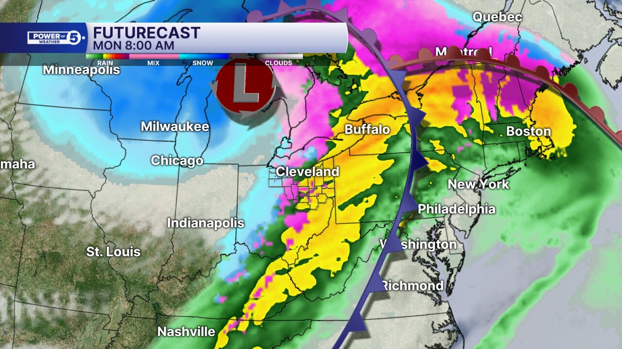
Wind gusts of 40 to 50+ mph are likely to continue into Monday as a cold front blasts through with a chance of severe thunderstorms. The cold front is likely to cross Northern Ohio around midnight. The cold front could bring isolated strong to severe storms, with damaging winds and minor flooding being the main threats.

By Monday morning, colder air will move in from the northwest as an area of low pressure continues to intensify behind the front. This will change the rain to a mix, and snow will begin to move in by the end of the workday on Monday.
Winds will remain very gusty throughout Monday, with gusts over 40 mph at times, reaching 60 mph. Highest gusts will occur along the lakeshore and in our western counties.


Lake effect takes over by Monday evening, with a burst of moderate snow possible for the evening commute and a few fluffy inches for most.

By the end of the afternoon on Monday and into the evening, winds will gradually slow as the area of low pressure moves out of the Great Lakes.
A cold and snowy pattern will linger for the rest of 2025, as highs fall into the 20s for most of the week. Lake effect could continue through Tuesday evening, with several more inches in the primary snowbelt, especially where squalls persist.

Snow chances will continue to be possible on New Year's Eve through Friday, as the cold pattern continues at the start of 2026. We finally see the light at the end of the snowy tunnel by Saturday, with highs in the mid to upper 20s.
Want the latest Power of 5 weather team updates wherever you go? Download the News 5 App free now: Apple|Android
Click here to view our interactive radar.
Follow the News 5 Weather Team:
Trent Magill: Facebook & Twitter
Katie McGraw: Facebook & Twitter
Phil Sakal: Facebook & Twitter
Allan Nosoff: Facebook & Twitter
