


CLEVELAND — Summer has begun! And it is going to feel like it...soon! Get ready to sweat and be sure to take care of yourself, take breaks inside, and be sure to stay hydrated. It might sound like common sense, but heat is the leading cause of weather fatalities and a silent killer, especially if you already have any health conditions.
An Extreme Heat Watch is in place for all of NEO for Sunday afternoon through Tuesday evening. This will be the time frame of the most dangerous heat for the region.
It will be mild tonight and dry with partly cloudy skies, accompanied by more warmth, as lows drop into the mid-to-upper 60s. A few more t-showers are possible on Saturday. These are most likely north and east, and in the first half of the day. Then a huge ridge of high pressure will build in, drying us out and heating up the temps!
It has been 294 days since Cleveland was last in the 90s. That looks to change as soon as this weekend. It will not only be hot, but humid as well, and heat index values could be in the upper 90s to 104 degrees.
Plan for 90s Sunday, Monday and Tuesday, and perhaps Wednesday. Storm chances look to return mid-week.
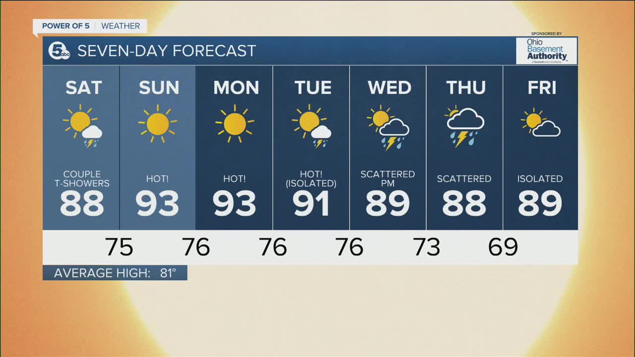
DAILY FORECAST:
Friday Night: Mild and partly cloudy! | Low: 69º
Saturday: Couple AM t'showers and heating up! | High: 88º
Sunday: Sunny. Hot! | High: 93º
Monday: Sunny & Hot! | High: 93º
Tuesday: Isolated storm & Hot! | High: 91º
Wednesday: Scattered t'storms. Not as hot. | High: 89º
Thursday: Scattered t'storms. Warm and muggy. | High: 88º
Download the News 5 app for the latest weather updates:
Follow the News 5 Weather Team:
Trent Magill: Facebook & Twitter
Katie McGraw: Facebook & Twitter
Phil Sakal: Facebook & Twitter
