


CLEVELAND — An air quality alert remains in effect until midnight. It will be a quiet night, with a few clouds, mild temperatures in the 60s, and areas of fog.
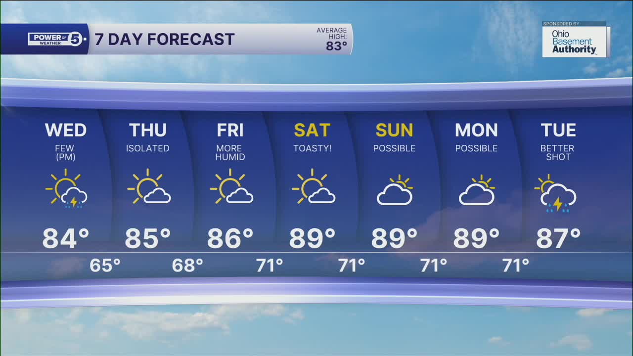
As we head into Wednesday, plan for more warmth and more humidity to build in for the rest of the week. Highs will be into the mid to upper 80s for the rest of the 7 7-day forecast. We could even get into the low 90s by the end of the work week. With the increasing humidity, it will feel even hotter and more sticky. Wednesday will start dry, but during the afternoon and evening, a few storms are expected to develop. These storms will be hit or miss, so it is not a guarantee to get rain. The *best shot* for rain will be in the western half of our viewing area during the late afternoon and early evening.
The severe weather threat looks low for Wednesday, but heavy rain is possible in any storms. Plus, these storms will be moving slowly. This means anyone who gets under one of these storms could receive a lot of rain in a short period, resulting in localized flooding.
Otherwise, rain chances will be very slim for the rest of the work week. At this time, next week is looking like it could become more unsettled with higher storm chances.
DAILY FORECAST:
Tuesday Night: Partly cloudy, mild temps.| Low: 65º
Wednesday: Partly cloudy and humid with a few storms. | High: 84º
Thursday: Hot and more humid. | High: 85º
Friday: Hot & humid.| High: 86º
Saturday: Hot again. | High: 89º
Download the News 5 app for the latest weather updates:
Follow the News 5 Weather Team:
Trent Magill: Facebook & Twitter
Katie McGraw: Facebook & Twitter
Phil Sakal: Facebook & Twitter
