


CLEVELAND — Clouds will be on the increase tonight, along with humidity levels. Temperatures will fall back into the lower 70s for most by early Wednesday. An isolated t'shower will be possible late.
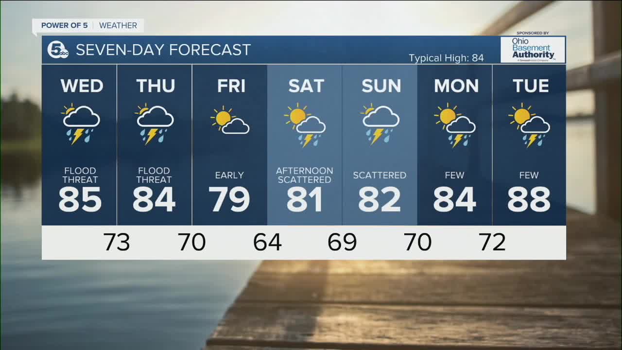
Scattered storms will be with us Wednesday and Thursday. Just like the last few weeks, these summer storms will be creating a feast or famine situation. Any storm that develops will pack a punch and will likely contain frequent lightning, gusty winds, and heavy rain that could lead to flooding. We will be watching for any strong or severe storms. The highest threat for damage is late Wednesday and once again on Thursday late. On the flip side, some communities will miss out on seeing any storms.
Storm chances fade Friday morning, as storms slide east and out of our southeastern communities. Much cooler air moves in for Friday, as highs will struggle to hit 80 for highs.
More rain will be moving in during the second half of Saturday and will linger into Sunday. Heat begins to build once again to begin the new work week.
DAILY FORECAST:
Tuesday Night: More clouds. Warmer and muggy. Isolated t'shower late. | Low: 72º
Wednesday: Storms likely with heavy rain. | High: 85º
Thursday: Storms likely with heavy rain. | High: 84º
Friday: Drying out early with GREAT temps. | High: 79º
Saturday: Storms return late. | High: 81º
Download the News 5 app for the latest weather updates:
Follow the News 5 Weather Team:
Trent Magill: Facebook & Twitter
Katie McGraw: Facebook & Twitter
Phil Sakal: Facebook & Twitter
