


CLEVELAND — After a rainy and stormy end to the afternoon, we will begin to dry out this evening across NE Ohio. Skies will remain mostly cloudy, but some clearing will take place after midnight. Some areas of fog will be possible during the second half of the overnight and early morning on Tuesday. Lows will bottom out in the mid to upper 60s for many.
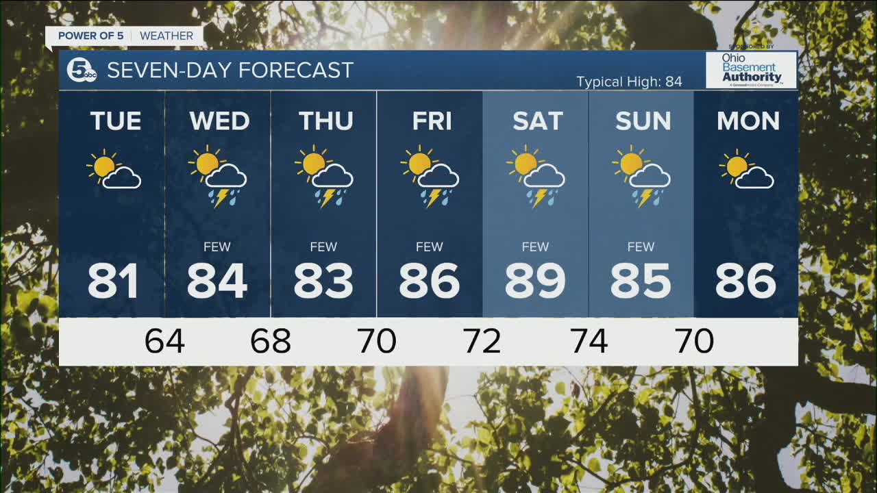
Temperatures will be much cooler on Tuesday, with daytime highs topping off in the upper 70s and lower 80s, which is a few degrees below average. Humidity levels will be much lower than the last few days.
Rain chances will return on Wednesday, but it will not be a total washout by any means. A few t'storms will be possible during the late afternoon and early evening. The threat for rain will continue into the end of the week, along with a bump in temperatures. Highs will approach 90 by Saturday.
DAILY FORECAST:
Monday Night: Drying out. Patchy Fog. | Low: 68º
Tuesday: Partly sunny. Less humid and cooler.| High: 80º
Wednesday: Warmer with a few storms.| High: 84º
Thursday: A few storms. | High: 83º
Friday: A few storms.| High: 86º
Download the News 5 app for the latest weather updates:
Follow the News 5 Weather Team:
Trent Magill: Facebook & Twitter
Katie McGraw: Facebook & Twitter
Phil Sakal: Facebook & Twitter
