


Remember! We turn back time at 2 am on Sunday! The sunset will be around 5:15 pm in Cleveland Sunday evening.
It was a very windy day on Saturday. Gusts reached between 35 and 45 mph in many locations and a communities farther west exceeded 50 mph gusts! Winds will decrease overnight as the cold front moves through.
A few showers are likely tonight and into early on Sunday. Showers will wrap up early on Sunday and the rest of the day looks pretty great!
Highs will be about 10 degrees colder than the record breaking temps on Saturday, but that is still 10 degrees above the average high temperature! Plus, it will not be nearly as breezy.
A drier cold secondary front slides through on Monday which will knock temperatures briefly down to seasonable levels. However, a few more mild days in the 60s are expected for the end of the week...and then...TEMPS CRASH.
What To Expect:
- Mild night with lows in the 50s
- Scattered overnight showers
- Drier, less breezy on Sunday
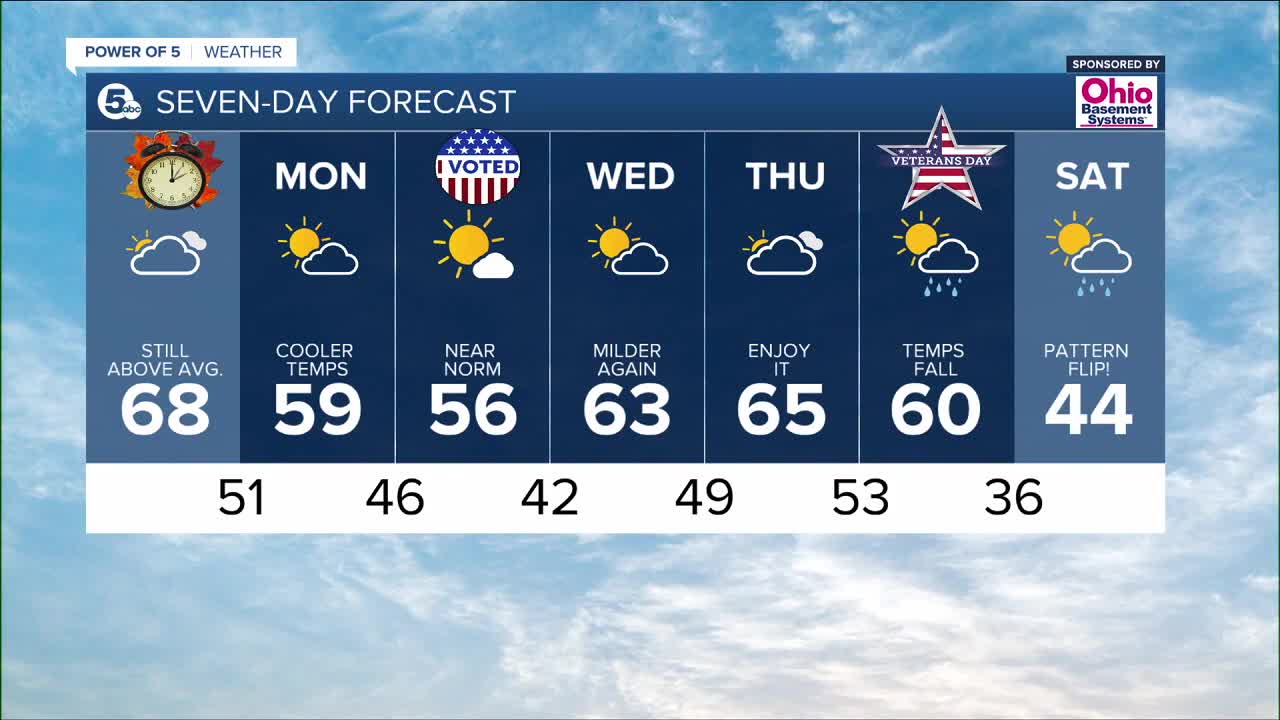
- Near Norm temps by Monday
- Pattern flip next weekend - hello cold!
Daily Breakdown:
Saturday Night: Scattered showers. Mild. Decreasing winds.| Low: 55º
Sunday: Cloud/sun mix. Still mild.| High: 68º
Monday: Sunny skies. Dry, but cooler| High: 59º
Tuesday: Seasonable & dry.| High: 56º
Wednesday: Bit warmer. Dry.| High: 63º
Thursday: Enjoy the warmth!| High: 65º
Download the News 5 app for the latest weather updates:
Follow the News 5 Weather Team:
Mark Johnson: Facebook & Twitter
Trent Magill: Facebook & Twitter
Katie McGraw: Facebook & Twitter
Phil Sakal: Facebook & Twitter
