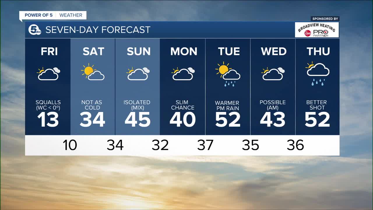


CLEVELAND — The core of the cold air floats across Ohio tonight with lows between 7 and 12 degrees by sunrise. Blustery winds will shift around to the south after midnight. Wind chills will drop a few degrees below zero at times. Light lake effect snow will gradual weaken and end overnight.
But the arctic air makes a quick retreat. By Saturday afternoon, high temperatures reach back up into the middle 30s with some sunshine. We are back in the 40s on Sunday. And get ready for some 50 degree highs by the middle of next week! Rain chances increase with the warmer air too. Rain showers are likely Tuesday thru Thursday of next week.
Stay connected with the News5 Weather Team!
What To Expect:
- Lows tonight near 10 degrees
- Wind chills below zero at times thru Saturday AM
- Seasonable Saturday with some sun
- 40s return Sunday
- Much warmer by next week
Daily Breakdown:
`
Friday Night: Very cold & blustery with light snow. | Low: 9º (wind chills below 0º)
Saturday: Not as cold. Looking dry. | High: 35º
Sunday: Warming up. Still cloudy. | High: 43º
Monday: Not too cold. Isolated. | High: 41º
Tuesday: Very mild with a few showers! | High: 51º
Wednesday: Scattered PM showers. | High: 48º
Thursday: More scattered rain showers. | High: 51º
Friday: Rain/snow mix. Cooler. | High: 37º
Download the News 5 app for the latest weather updates:
Follow the News 5 Weather Team:
Mark Johnson: Facebook & Twitter
Trent Magill: Facebook & Twitter
Katie McGraw: Facebook & Twitter
Phil Sakal: Facebook & Twitter
