


CLEVELAND — Severe storm threat is decreasing but more rounds of rain will keep the flood threat elevated through tonight.
A slow-moving cold front will sit just to our northwest tonight. We have already dealt with multiple rounds of strong to severe storms. I think the worst is over. But with the cold front & area of low pressure still to our west, I can't rule out a few showers and storms redeveloping overnight through early Sunday. These storms however, are not expected to be severe.
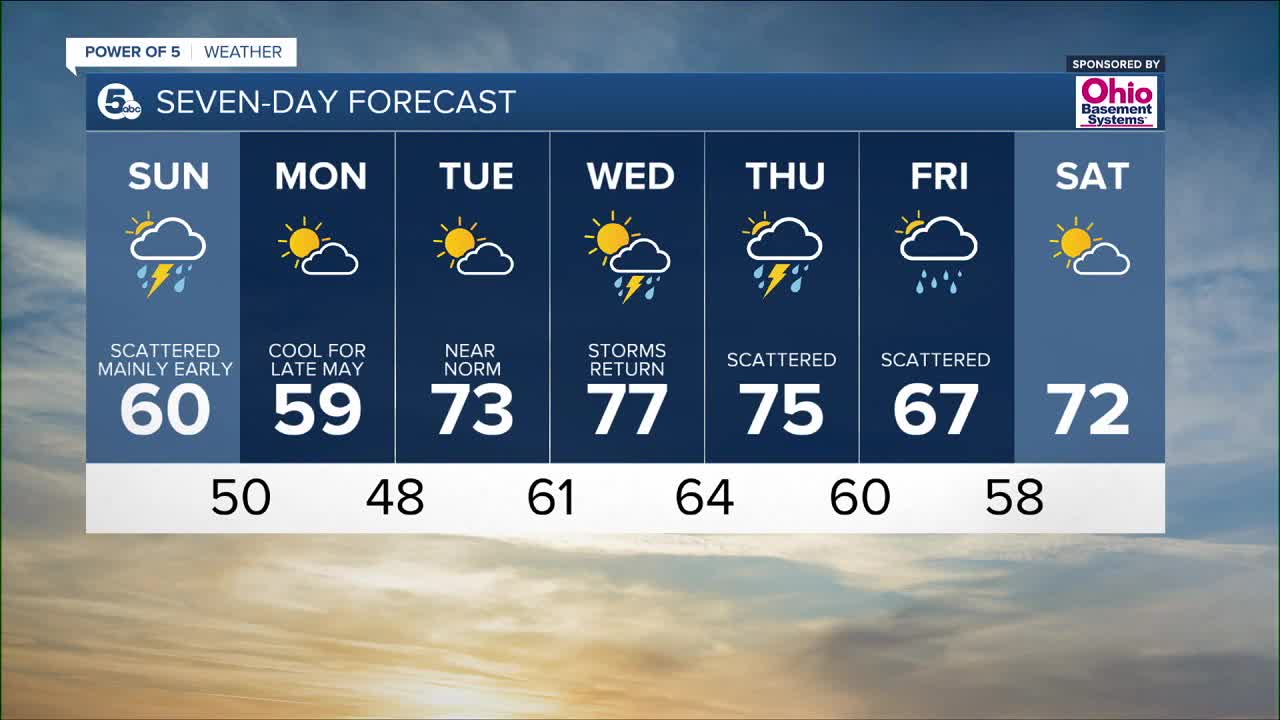
Thundershowers linger Sunday morning with temperatures falling out of the 60s into the 50s closer by lunch time. Marathon Runners can expect a few showers Sunday morning with temperatures falling into the 50s during the race. Drier air should works its way in by Sunday afternoon. The Akron/Canton/Mansfield areas should hold on to milder temperatures a bit longer but it will be considerably cooler than Saturday. Grab the Spring jacket!
FORECAST HEADLINES
- Rain and a few rumbles of thunder tonight
- Watch for some flooded roads
- Temps much cooler Sunday
- Drying out Sunday afternoon
- Cool and dry for Monday
DETAILED FORECAST:
Tonight: Rain and a few t-showers. Minor flooding possible. Still mild. | Low: 67º
Sunday: Mostly cloudy with scattered t-showers early. Cooler. Falling temps during the afternoon. Drying out by afternoon.| Morning High: 67º falling to around 60º by 4pm
Monday: Much Cooler & drier. | High: 59º
Tuesday: Partly cloudy, seasonable.| High: 73º
Download the News 5 app for the latest weather updates:
Follow the News 5 Weather Team:
Mark Johnson: Facebook & Twitter
Trent Magill: Facebook & Twitter
Remeisha Shade: Facebook & Twitter
Katie McGraw: Facebook & Twitter
