


CLEVELAND — Coldest air of the season arrives as we begin the new work week, along with our first shot at seeing flakes! Tuesday looks to be the most active with occasional rain/snow all day long. It will be very blustery as well - making it feel even colder. We will begin to moderate as we end the work week, as highs top off in the 50s to near 60 by Thursday and Friday.
What To Expect:
- Clouds return
- Blustery conditions linger
- Cold next week!
- Flakes mixed with rain too!
- Warming by the end of the week
Daily Breakdown:
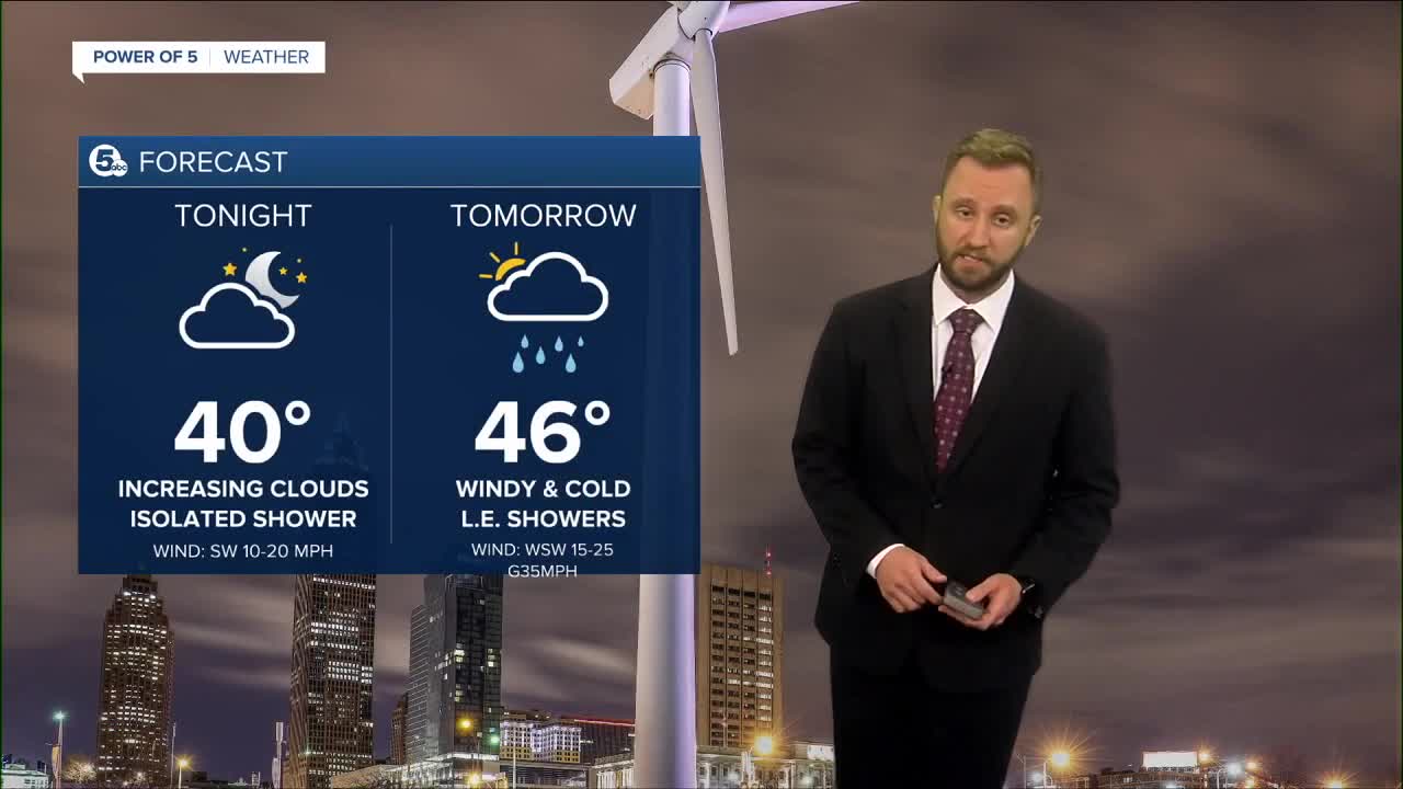
Monday: Scattered lake effect rain showers. Windy. Even colder.| High: 46º
Tuesday: Scattered lake effect rain (Wet snow flakes). Windy!| High: 44º
Wednesday: Scattered lake effect rain/snow. Still cold.| High: 45º
Thursday: Drying out. Not as chilly.| High: 50º
Friday: Partly cloudy. Not as cool.| High: 61º
Saturday: Partly cloudy. Warmer| High: 67º
Download the News 5 app for the latest weather updates:
Follow the News 5 Weather Team:
Mark Johnson: Facebook & Twitter
Trent Magill: Facebook & Twitter
Katie McGraw: Facebook & Twitter
Phil Sakal: Facebook & Twitter
