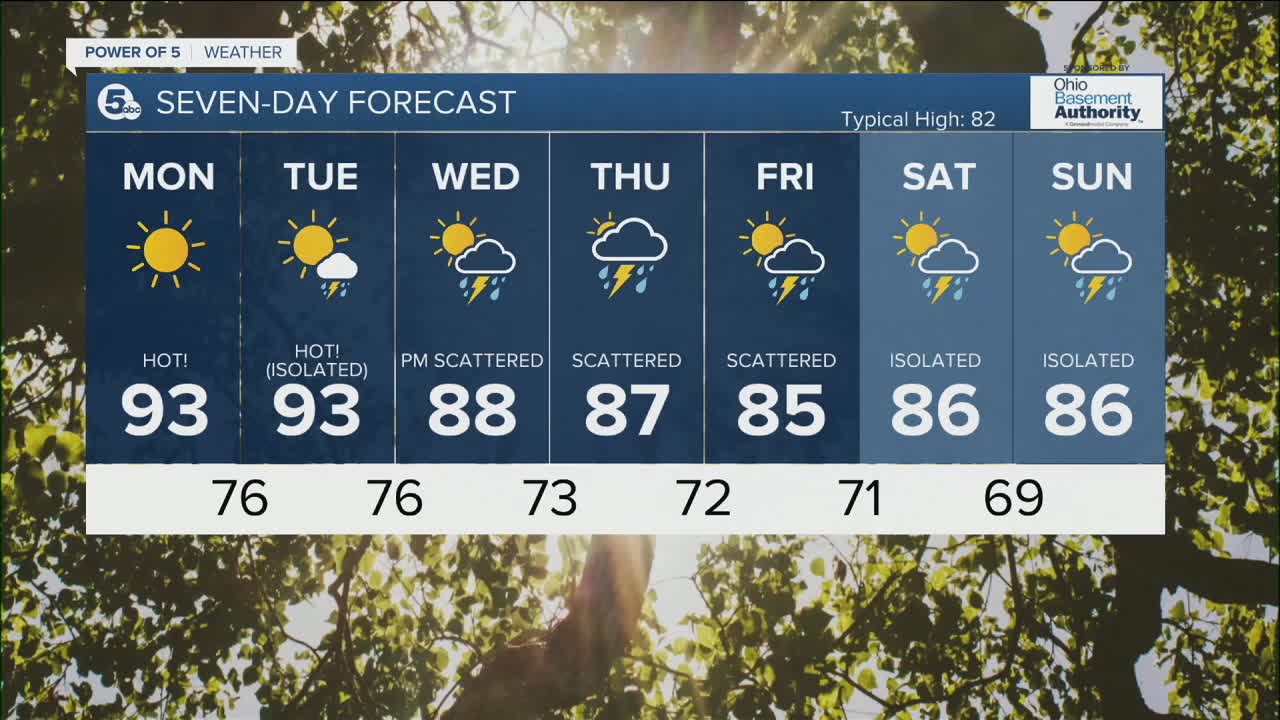


CLEVELAND — Not a lot of relief during the overnight hours from the heat and humidity. Lows will only drop into the low to mid 70s for many tonight, under mostly clear skies.
Heat Advisory continues through the evening on Tuesday for all of NEO. With temperatures in the low to mid 90s along with dew points in the upper 60s and lower 70s; heat index values will be in the upper 90s and lower 100s during peak heating on Monday and Tuesday.
An isolated storm chance will return on Tuesday, with a strong storm possible. More showers and storms will begin to move in for the middle and end of the week, with temperatures slightly cooler. Highs will top off in the mid to upper 80s, along with muggy conditions.
DAILY FORECAST:
Sunday: Mostly clear. Warm & muggy. | Low: 73º
Monday: Sunny & Hot! | High: 93º
Tuesday: Isolated storm & Hot! | High: 92º
Wednesday: Scattered t'storms. A little cooler. | High: 89º
Thursday: Scattered t'storms. | High: 89º
Download the News 5 app for the latest weather updates:
Follow the News 5 Weather Team:
Trent Magill: Facebook & Twitter
Katie McGraw: Facebook & Twitter
Phil Sakal: Facebook & Twitter
