


CLEVELAND — Isolated storm chances will linger through the evening, but will begin to taper off after sunset into the overnight. It will remain warm and muggy, as lows drop only into the upper 60s and lower 70s.
A few isolated storm chances will return on Thursday, especially during the afternoon. A strong storm or two will be possible, with gusty winds and heavy rain being concerns. Temperatures and humidity will remain high once again.
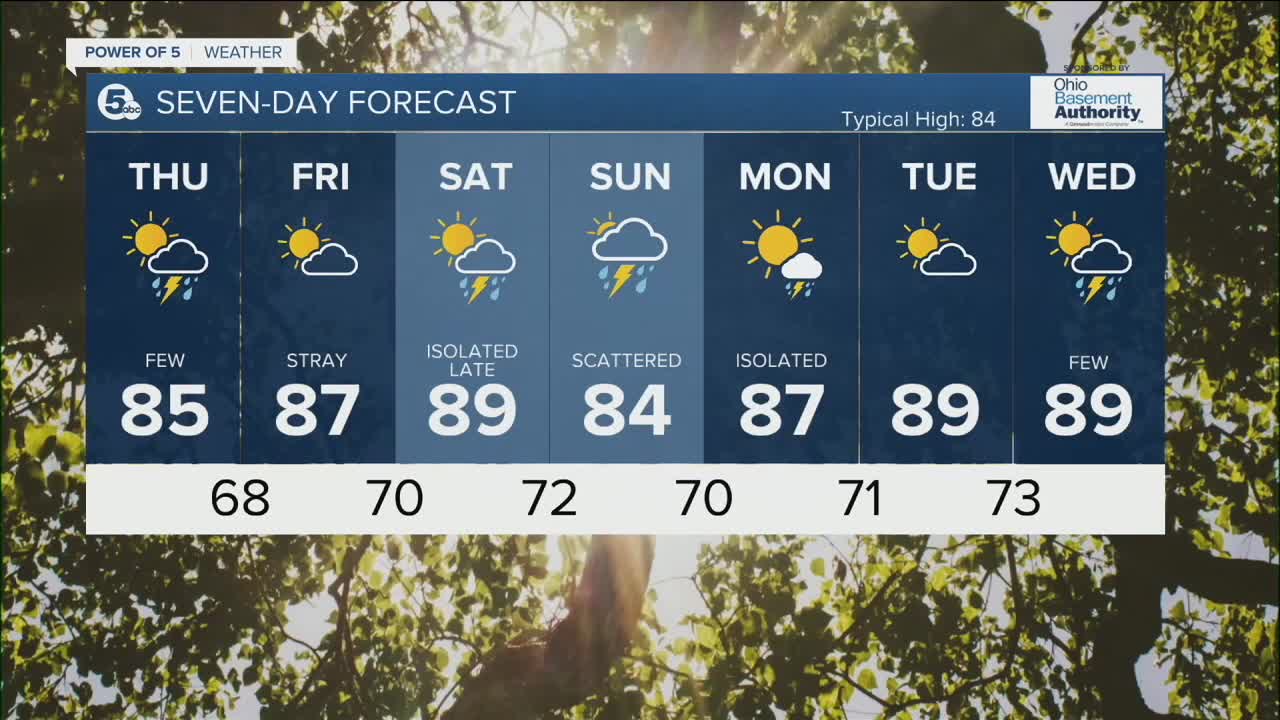
We will see more heat and humidity to round out the week, along with drier conditions. Temps will be approaching 90 by Saturday.
Scattered showers and storm chances will be increasing late Saturday into Sunday; the best chance for more widespread rain for NEO.
DAILY FORECAST:
Wednesday Night: Storms taper off. Warm & muggy.| Low: 69º
Thursday: Few Storms. Strong possible. Warm & muggy. | High: 85º
Friday: Drier and warmer.| High: 87º
Saturday: Hot and humid with a few storms late in the day. | High: 89º
Sunday: Scattered storms. | High: 84º
Download the News 5 app for the latest weather updates:
Follow the News 5 Weather Team:
Trent Magill: Facebook & Twitter
Katie McGraw: Facebook & Twitter
Phil Sakal: Facebook & Twitter
