


CLEVELAND — While we have a chance of isolated pop-up thunderstorms during the evening and overnight, the best chance for rain will arrive on Monday with a front moving through the region. Ahead of the boundary, it will be another warm and muggy overnight, with lows in the low to mid 70s.
Our severe risk remains low, but a few storms could become strong before cooler air pays us a visit on Tuesday. Temperatures will top off in the mid 80s on Monday, and drop a few degrees with less humid conditions on Tuesday
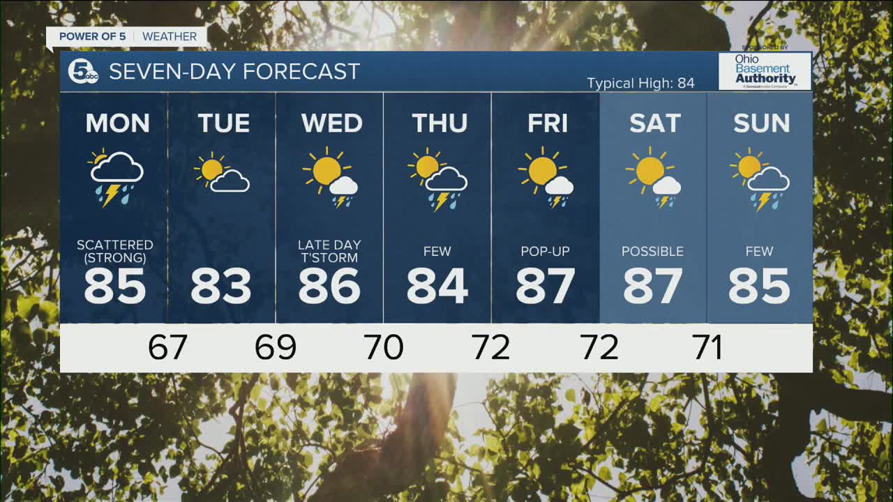
The rest of the week looks seasonable with pop-up showers and storms.
DAILY FORECAST:
Sunday Night: Isolated t'shower. Warm & muggy. | Low: 74º
Monday: Scattered storms. Few could be strong. | High: 85º
Tuesday: Drier and less humid.| High: 81º
Wednesday: Few storms possible late. Warm.| High: 86º
Thursday: Few storms possible.| High: 84º
Friday: Pop-up storm chance.| High: 87º
Download the News 5 app for the latest weather updates:
Follow the News 5 Weather Team:
Trent Magill: Facebook & Twitter
Katie McGraw: Facebook & Twitter
Phil Sakal: Facebook & Twitter
