


CLEVELAND — A few showers and or a rumble of thunder will be possible late tonight, with some areas of fog possible. Temperatures will only fall back to around 70, along with muggy conditions.
A cold front will bring a few showers and storms to the region on Sunday, especially during the morning, but by midday, we will begin to dry out from west to east. Temperatures will top off in the mid to upper 80s, along with muggy conditions. Some sunshine will be had during the afternoon and evening on Sunday.
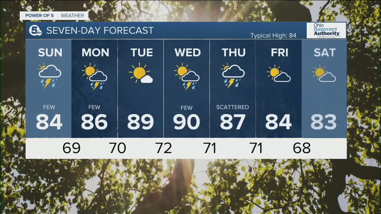
A few showers and or rumble of thunder will be possible on Monday, as highs once again top off in the mid to upper 80s. More heat builds for Tuesday and Wednesday, with highs around 90. Another round of showers and storms will move in late Wednesday through Thursday as a cold front moves through. Behind this front, we will begin to cool for the end of the week, with highs in the lower 80s by Friday and next Saturday.
DAILY FORECAST:
Saturday: Warm and muggy. Storms linger this evening. | Low: 71º
Sunday: Few storms. Muggy but cooler. | High: 84º
Monday: Few t'showers possible. Muggy. | High: 86º
Tuesday: Hotter! More sunshine. | High: 89º
Wednesday: Hot & humid. Few storms are possible. | High: 90º
Thursday: Scattered storms. Muggy. | High: 87º
Friday: Drier with more sunshine. | High: 84º
Download the News 5 app for the latest weather updates:
Follow the News 5 Weather Team:
Trent Magill: Facebook & Twitter
Katie McGraw: Facebook & Twitter
Phil Sakal: Facebook & Twitter
