


CLEVELAND — Tonight will be *crisp* under mostly clear skies and calm winds. Lows will drop into the 50s for much of NEO. It will be a great night to turn off the A/C and open those windows!
Expect more sunshine and picture-perfect temperatures for your Tuesday, although it will be slightly warmer than Monday. 80s return, which will make it about 5 degrees warmer over 24 hours, but it will remain comfortable with low humidity.
A ridge of high pressure is building over the region. This ridge will keep us dry for several days and increase our temperatures + humidity.
Temperatures soar by the middle of the week, along with increased humidity. Highs will top off in the lower 90s by Wednesday and continue through the end of the work week. With higher dew points, it could feel like the upper 90s to low triple digits.
Storm chances will begin to return on Friday and are expected to linger into the weekend.
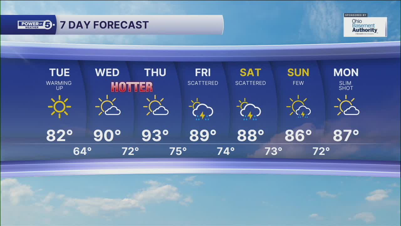
DAILY FORECAST:
Monday Night: Clear, calm, and cool.| Low: 58º
Tuesday: Sunny again and slightly warmer. | High: 82º
Wednesday: Heat building. | High: 90º
Thursday: Hot again. | High: 92º
Friday: Hot with a few storms possible. | High: 89º
Saturday: Hot & humid with scattered storms. | High: 88º
Sunday: Still hot, still humid, still unsettled. | High: 87º
Download the News 5 app for the latest weather updates:
Follow the News 5 Weather Team:
Trent Magill: Facebook & Twitter
Katie McGraw: Facebook & Twitter
Phil Sakal: Facebook & Twitter
