


CLEVELAND — A cold front is sliding across the region. This front brought morning showers and sparked some widely scattered storms Tuesday afternoon and evening. There were even reports of waterspouts and funnel clouds around 2 pm near The Islands.
This cold front will not drop our temperatures all that much, but it will bring lower humidity tomorrow (albeit for a short period).
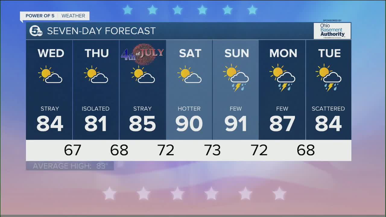
Following a very active June, there are limited rain chances over the next several days. Only stray t-showers are expected on Wednesday and Thursday.
The Fourth of July weekend looks mainly dry and hot as well!
The 4th looks great, with only a slim chance of rain and seasonal temperatures in the mid-80s. Both Saturday and Sunday will be hot and humid again. Isolated storms are possible on Sunday, but the better chance for storms holds off until Monday or Tuesday.
DAILY FORECAST:
Tuesday Night: Drier, humidity drying. | Low: 67º
Wednesday: Less humid but still hot.| High: 84º
Thursday: Partly cloudy with a slim shot at rain.| High: 84º
Independence Day: Beautiful sun and seasonable heat!| High: 85º
Saturday: Big heat and humidity.| High: 90º
Sunday: Another hot day with a few storms possible. | High: 92º
Download the News 5 app for the latest weather updates:
Follow the News 5 Weather Team:
Trent Magill: Facebook & Twitter
Katie McGraw: Facebook & Twitter
Phil Sakal: Facebook & Twitter
