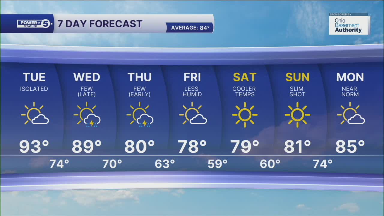


CLEVELAND — The strong and severe storms from this evening have exited NEO! The rest of tonight will be quiet with partly cloudy, warm, and muggy with light winds. Areas of fog are possible overnight and into early Tuesday. Isolated storm chances are possible tomorrow as well, but the bigger story will be THE HEAT!
We were back in the 90s today and will repeat that on Tuesday (and it could be a couple degrees warmer than today). It will also feel even hotter with the humidity, as heat index values will be well into the 90s and could approach triple digits in a few locations. A heat advisory will be in effect from noon until 8 pm on Tuesday. Be sure to have a way to stay cool!
A cold front is expected to move through mid-week. A few storms are possible late on Wednesday and into Thursday, bringing significantly cooler and more comfortable air by the end of next week and continuing into the weekend.
DAILY FORECAST:
Tuesday: Isolated storms. Even hotter. Even more humid. | High: 92º
Wednesday: Scattered PM storms. | High: 85º
Thursday: A few storms, cooler. | High: 80º
Friday: More sunshine & comfortable. | High: 78º
Saturday: Sunny and pleasant. | High: 79º
Download the News 5 app for the latest weather updates:
Follow the News 5 Weather Team:
Trent Magill: Facebook & Twitter
Katie McGraw: Facebook & Twitter
Phil Sakal: Facebook & Twitter
