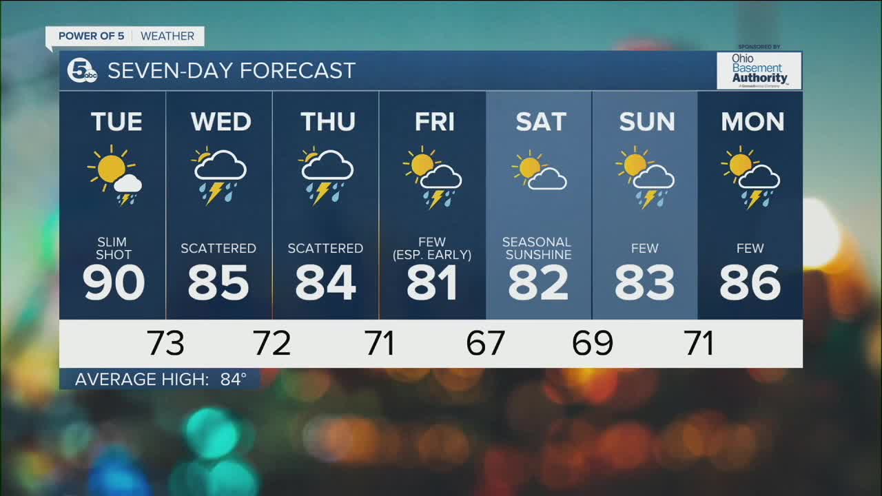


CLEVELAND — After some morning showers, the rest of your Monday has been predominantly dry. That is a theme that will continue tonight and into Tuesday. Plan for a very isolated shower on Tuesday, otherwise it will be dry and hot! Highs will be near 90 degrees. After that, the rest of the week will be seasonal with temperatures in the low and mid-80s.
Rain chances increase mid-week. Plan on scattered storms both Wednesday and Thursday. Just like the last few weeks, these storms look to be hit or miss, creating a feast or famine situation. Any storm that develops will pack a punch and will likely contain frequent lightning, gusty winds, and heavy rain that could lead to flooding. We will be watching for any strong or severe storms. The highest threat for damage is late Wednesday. On the flip side, some communities will miss out on seeing any storms.
Storm chances diminish on Friday, with the best opportunity for rain occurring earlier in the day and in our southeastern communities. As of Monday evening, it looks to be a 50/50 weekend. Saturday is trending dry with more rain and storms on Sunday.
DAILY FORECAST:
Monday Night: Patchy fog. Calm and clear. | Low: 66º
Tuesday: Hotter! More sunshine. | High: 90º
Wednesday: Scattered thunderstorms. | High: 85º
Thursday: Scattered storms. | High: 84º
Friday: Drier with more sunshine. | High: 81º
Saturday: Looks dry and seasonal. | High: 82º
Download the News 5 app for the latest weather updates:
Follow the News 5 Weather Team:
Trent Magill: Facebook & Twitter
Katie McGraw: Facebook & Twitter
Phil Sakal: Facebook & Twitter
