


CLEVELAND — The fabulous weather conditions continue into tonight! Temperatures will remain very comfortable in the mid to low 70s and low humidity with variable clouds, light winds. Some areas of fog are possible overnight.
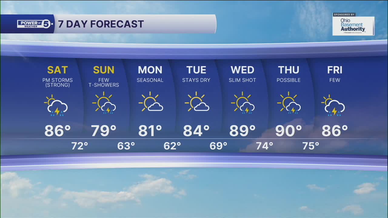
More storms are expected to return this weekend, but rain is not anticipated to persist throughout the entire weekend. You should get tons of dry time Saturday morning and afternoon with more heat (temps in the mid-80s) and more humidity, but we encourage you all to listen for thunder, especially by Saturday evening.
Storms are most likely to move into western Ohio after 6 pm and will continue to slide east, but weakening as they do so. We remain under a SLIGHT RISK, meaning a 2 out of 5 chance of SEVERE STORMS, and it looks like the best chance to see these strong or severe storms will be west of Cleveland. We will be watching for damaging winds, frequent lightning, and heavy rain that could lead to flash flooding.
Be sure to have a plan to seek shelter for any outdoor plans you have on Saturday evening. A few more t-showers are expected on Sunday and are expected to end from north to south throughout the day. The 90s will try to make a return next week with more hit-and-miss storms.
DAILY FORECAST:
Friday Evening: More clouds south, otherwise comfortable and dry. | Temps: Low 70's
Saturday: Hot, humid, and unsettled with damaging storms possible. | High: 87º
Sunday: A few t-storms. | High: 79º
Monday: Looking dry and warm. | High: 80º
Download the News 5 app for the latest weather updates:
Follow the News 5 Weather Team:
Trent Magill: Facebook & Twitter
Katie McGraw: Facebook & Twitter
Phil Sakal: Facebook & Twitter
