


CLEVELAND — Scattered storms have been fading this evening, and that looks to continue tonight, but it will remain warm and muggy with variable clouds. Patchy fog will be possible as well into early on Thursday.
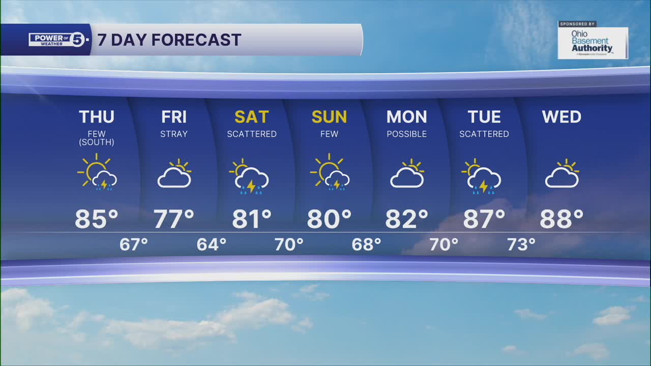
Isolated t-showers are possible on Thursday, but the coverage will be MUCH lower than Wednesday with less of an impact. The greatest chance for storms will be in southern Ohio. It will remain seasonably warm and super muggy. Highs will be in the mid-80s with breezy winds. Winds will be out of the west and could gust up to 25 mph. These breezy winds will make the lake dangerous tomorrow with waves of 4-7 feet and a high risk for rip currents.
It remains predominantly dry on Friday and will be notably cooler and less humid with highs in the 70s. More storm chances return this weekend, and 90s will try to make a return next week with more hit-and-miss storms.
DAILY FORECAST:
Wednesday Night: Patchy fog. Stray showers and warm. | Low: 74º
Thursday: A few thunderstorms, mainly south. | High: 85º
Friday: Partly sunny with comfortable temps. | High: 77º
Saturday: Scattered thunderstorms. | High: 83º
Sunday: Scattered t-storms. | High: 81º
Download the News 5 app for the latest weather updates:
Follow the News 5 Weather Team:
Trent Magill: Facebook & Twitter
Katie McGraw: Facebook & Twitter
Phil Sakal: Facebook & Twitter
