


CLEVELAND — Following 3 days of 90s and high humidity, storms are back in the forecast.
We tracked a few strong and severe storms this evening. They grew quickly with heavy rain, frequent lightning, and some gusty winds. These storms are expected to fade around midnight. It should be mainly dry tonight with partly cloudy skies and warm temperatures.
Wednesday looks to start dry, but plan for more storms to move in Wednesday through the end of the week. With the increased cloud cover and rain chances, temperatures will not be as hot, but they will still be above average, with temperatures in the mid to upper 80s. Plus, the humidity will linger for the rest of the week. It does not look like the humidity will drop until the middle of NEXT week.
Along with the warmth and humidity, it will remain unsettled for the whole week as well. The best chance for storms will be during the heat of the day in the afternoons and evenings, with storms waning at night. Heavy rain, frequent lightning, and some gusty winds will be possible from any storms for the rest of the week.
Stay cool!
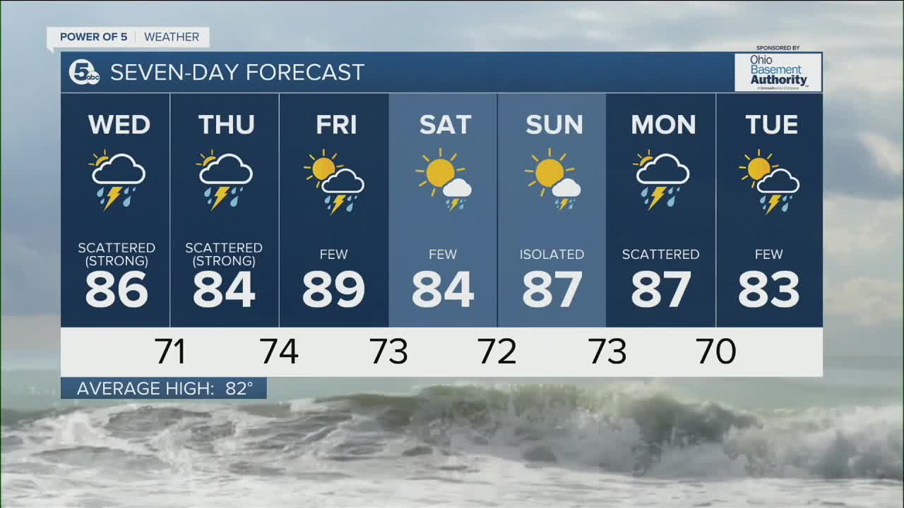
DAILY FORECAST:
Tuesday Night: Storms fade. Warm and sticky. | Low: 73º
Wednesday: Scattered t-storms. Could be strong. Not as hot but still Muggy. | High: 86º
Thursday: Scattered t-storms. Could be strong. Muggy. | High: 84º
Friday: A few t-storms. | High: 86º
Saturday: A few t-storms. Still warm and muggy. | High: 84º
Download the News 5 app for the latest weather updates:
Follow the News 5 Weather Team:
Trent Magill: Facebook & Twitter
Katie McGraw: Facebook & Twitter
Phil Sakal: Facebook & Twitter
