


CLEVELAND — Plan for scattered showers and storms to return to wrap up the month of June and to start the month of July across NEO.
On and off storms joined us on Monday with heavy rain that led to flooding across several communities. These storms will fade overnight. It will be partly cloudy, warm, and muggy tonight with lows in the upper 60s to the low 70s.
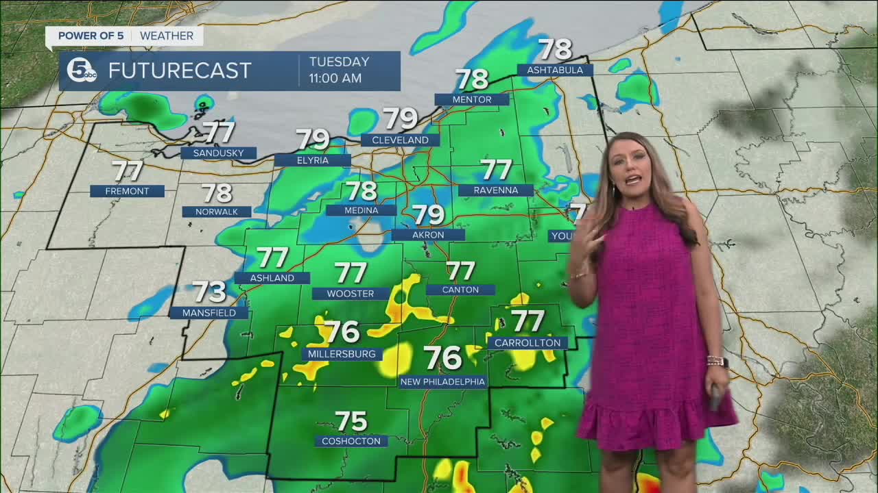
Most of the night will be dry, but showers look possible as early as Tuesday morning. The severe threat is very low early on Tuesday. However, spotty storms could get a little feisty again on Tuesday afternoon. Tuesday's storms look like they'll impact our southern counties mostly during the afternoon and evening.
As the cold front slides through, we will be much drier and less humid by Wednesday, with limited rain chances for the rest of the 7-day forecast!
As of now, the Fourth of July weekend looks mainly dry and hot. The 4th looks great with only a slim shot for a shower and seasonal temperatures in the mid-80s. Both Saturday and Sunday will be hot, and a few storms are possible on Sunday. We'll keep an eye on it!
DAILY FORECAST:
Monday Night: Storms fade, warm and muggy. | Low: 70º
Tuesday: Scattered storms, could be strong. | High: 84º
Wednesday: Less humid and drier.| High: 82º
Thursday: Partly cloudy with a slim shot at rain.| High: 81º
Independence Day: Beautiful sun and seasonable heat!| High: 85º
Saturday: Big heat and humidity.| High: 90º
Sunday: Another hot day with a few storms possible. | High: 91º
Download the News 5 app for the latest weather updates:
Follow the News 5 Weather Team:
Trent Magill: Facebook & Twitter
Katie McGraw: Facebook & Twitter
Phil Sakal: Facebook & Twitter
