


CLEVELAND — We're on our way to a nice thaw. Back to near normal temps... eventually. Temperatures were about 10-15 degrees warmer than Wednesday, but it was still frigid on Thursday with highs only reaching the mid-20s, plus there were some evening snow showers that dropped a trace to 1.5'' for much of the area.
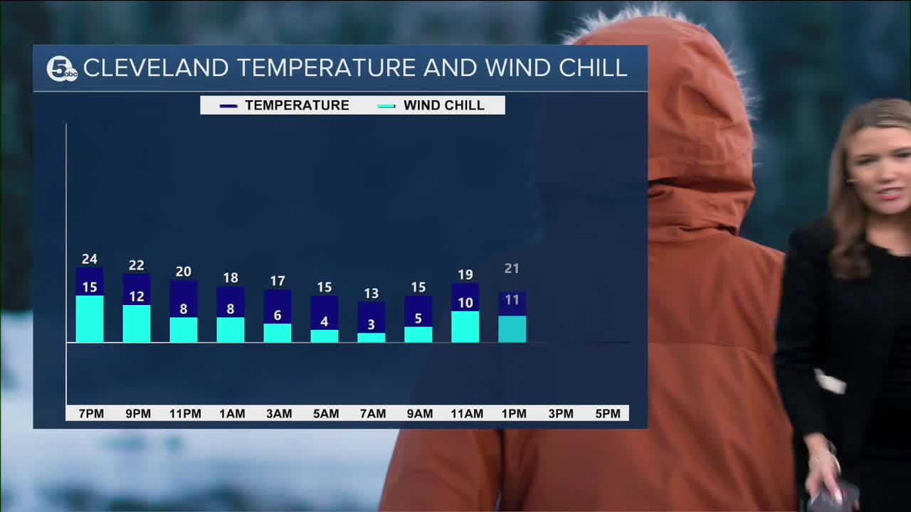
Overnight, snow showers will fade and it will be quiet and cold. Wind chills will still be in the single digits tomorrow morning. The snow that moved through Thursday evening, was brought to us by a weak cold front. Therefore, afternoon temperatures on Friday are expected to be a smidge cooler. Highs will likely be in the low 20s, a couple of degrees colder than Thursday and well below normal. For perspective, the average highs at this time of year are in the middle 30s.
We're pushing 30º on Saturday and Sunday with a few more snow showers - mainly Saturday afternoon/evening. It looks like we could reach the lower 30s by early next week.
DAILY FORECAST:
Thursday Night: Snow showers fade. Cold night.| Low: 15º
Friday: Mostly cloudy, freezing and dry.| High: 22º
Saturday: Few snow showers. Minor accumulation.| High: 31º
Sunday: Couple of flakes. Freezing temps.| High: 28º
Monday: Warming nicely into the lower 30s! | High: 33º
Download the News 5 app for the latest weather updates:
Follow the News 5 Weather Team:
Mark Johnson: Facebook & Twitter
Trent Magill: Facebook & Twitter
Katie McGraw: Facebook & Twitter
Phil Sakal: Facebook & Twitter
