


CLEVELAND — A slim shot of a t'shower during the overnight across Northeast Ohio. Otherwise, look for more clouds, along with warm and muggy conditions. Lows will only fall back into the lower 70s for many.
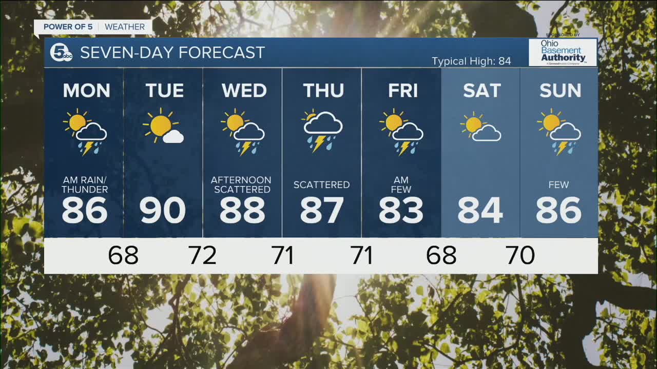
Rain and some thunder will move in for the morning drive on Monday, while not heavy, it may have an impact on the commute. We expect to dry it out by Monday afternoon and Tuesday, with temperatures returning to the lower 90s by Tuesday.
Rain and storm chances return Wednesday afternoon and Thursday. Temperatures will begin to cool to round out the week, as highs fall into the lower 80s on Friday and Saturday.
DAILY FORECAST:
Sunday Night: More clouds. Slim Shot of t'shower. Muggy. | Low: 72º
Monday: Morning rain chances, dry by the afternoon. | High: 86º
Tuesday: Hotter! More sunshine. | High: 90º
Wednesday: Hot & humid. Scattered PM storms. | High: 88º
Thursday: Scattered storms. Muggy. | High: 87º
Friday: Drier afternoon, with more sunshine. | High: 83º
Download the News 5 app for the latest weather updates:
Follow the News 5 Weather Team:
Trent Magill: Facebook & Twitter
Katie McGraw: Facebook & Twitter
Phil Sakal: Facebook & Twitter
