
Rest of the Weekend:
Scattered snow showers have been falling since Saturday evening. Most of this is very light, but there will be periods of low visibility with more intense bands. Snow showers will gradually taper off this afternoon and linger in our eastern communities. Otherwise, Sunday will be cloudy, cold, and breezy! Highs will likely stay in the 30s all day.

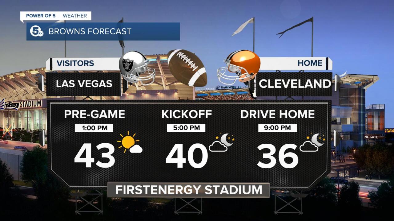
Browns Game:
High pressure will move into the area and gradually clear out the skies. If clouds clear very fast Sunday night, Monday morning will be frigid! I think morning temperatures will be in the 20s for most of Northeast Ohio. After a cold start, sunshine will return with a few clouds during the afternoon with seasonable temperatures. If you are going to the Browns game - it looks dry but chilly!!
Winter Begins!
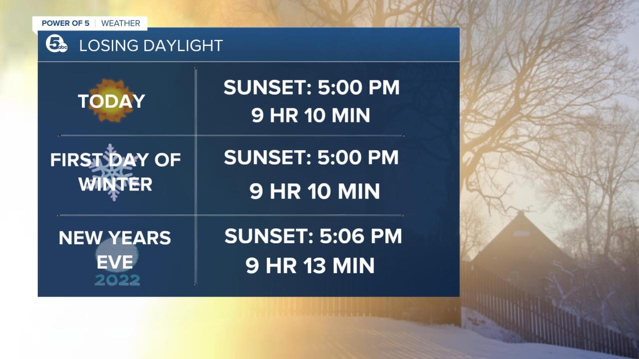
The winter solstice is Tuesday! We officially change seasons on December 21 at 10:59 am. This is the shortest day of the year with nine hours and 10 minutes of daylight in Cleveland (we only lose about 16 seconds over the next two days). By January 1 – we will have already gained three minutes of daylight! A weak cold front will slide through the area late Monday and Tuesday. Moisture is limited with this front, but you will likely notice more clouds and slightly cooler temperatures. Most of this week will be quiet! However, there is a system approaching the area late in the week.
The Probability of a White Christmas:
Looking back at 127 years of data, Cleveland has had a White Christmas (1’’ of snow on the ground) 52 times (41% of the time). Measurable falling snow on Christmas day is even less likely – occurring only 46 times (36% of the time). You may recall Christmas 2020 had both! 4.2’’ of snow fell on Christmas day last year and a snow depth of 7’’! However, this information tells us that we see a Green Christmas more often than a White Christmas.

WHAT WILL IT BE: A Green or White Christmas?
So - what about this year? As I mentioned, there is a system moving toward the area at the end of the week. As of Sunday morning, it looks like this system will bring warming temperatures and rain showers to the area rather than cold and snow. The 6-10 day outlook from the Climate Prediction Center has a strong signal for above-average temperatures over that period. I think mild temperatures in the FIFTIES will be possible on Christmas Day and that means a Green Christmas is likely this year.
With that said – it is still several days out and we will continue to monitor the system. The Power of 5 Weather Team will update you all week long!

