


CLEVELAND — A warm and muggy evening, with skies becoming mostly clear. Some patchy fog will be possible, as lows only drop to around 70 by early Monday morning.
We are back into the heat for the start of the new work week, as highs top off in the lower 90s Monday and Tuesday with limited pop-up chances. It will feel even hotter with the humidity, as heat index values will be well into the 90s and could approach triple digits in a few locations.
A cold front is expected to move through mid-week, bringing significantly cooler and more comfortable air by the end of next week.
DAILY FORECAST:
Sunday Night: Warm & muggy. Patchy fog. | Low: 72º
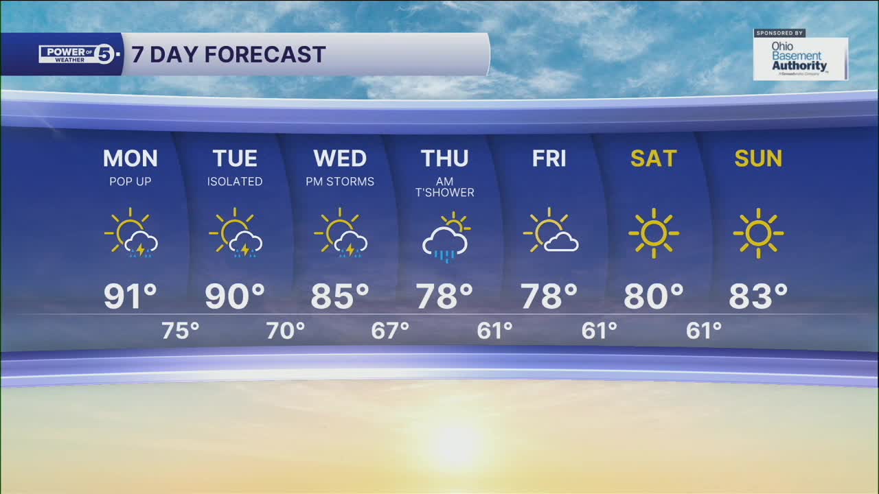
Monday: Hot & muggy. Pop-up storm chance. | High: 91º
Tuesday: Isolated storms. Warm & muggy. | High: 90º
Wednesday: Scattered PM storms. | High: 85º
Thursday: AM t'shower. Cooler. | High: 78º
Friday: More sunshine & comfortable. | High: 78º
Saturday: Sunny and pleasant. | High: 80º
Download the News 5 app for the latest weather updates:
Follow the News 5 Weather Team:
Trent Magill: Facebook & Twitter
Katie McGraw: Facebook & Twitter
Phil Sakal: Facebook & Twitter
