


CLEVELAND — Still hot. Still humid... Not quite "Heat advisory Criteria" for all of us, but we're within a few degrees. So, still play it safe. Continue drinking water, taking breaks, and seeking shade or air conditioning. Friday looks to be back in the 90s and feeling super sticky!
The high heat and humidity, plus a front, will bring ANOTHER chance for storms on Friday. These will be widely scattered during the afternoon, but we will have to watch a line of storms ahead of a cold front to our west throughout the day.
If the line stays together, it looks like it could arrive by Friday evening/night with the greatest potential for storms or any severe weather outside of our viewing area in Northwestern Ohio. Once again, we will be watching for heavy rain that could lead to flooding, frequent lightning, and damaging gusty winds.
This weekend will be a bit cooler, with temperatures on Saturday in the low 80s. A few storms are possible on Saturday, especially early and in our southern and eastern communities as the front clears the area, but Sunday looks mainly dry. It will also be *slightly* less humid.
However, storm chances ramp up again on Monday and Tuesday - but that looks to be when this pattern finally flips!
Stay cool!
DAILY FORECAST:
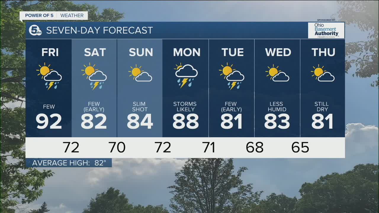
Thursday Night: Stray showers. Muggy. | Low: 73º
Friday: A few t-storms. | High: 92º
Saturday: A few t-storms. Not as warm, but muggy. | High: 82º
Sunday: Mainly dry. Slim shot for a storm. | High: 87º
Monday: Hot, humid, and stormy. | High: 89º
Download the News 5 app for the latest weather updates:
Follow the News 5 Weather Team:
Trent Magill: Facebook & Twitter
Katie McGraw: Facebook & Twitter
Phil Sakal: Facebook & Twitter
