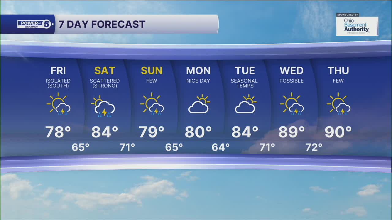


CLEVELAND — Isolated showers are possible this evening, but it is only a teeny tiny chance! Otherwise, it will be dry with variable clouds and comfortable temperatures in the mid and low 60s. The breezy winds that joined us today will be decreasing tonight and into Friday and will become more northerly as a cold front slides through the region.
This cold front will drop temperatures a couple of degrees on Friday and lower humidity even more! It will feel GREAT tomorrow afternoon with temperatures in the upper 70s and low 80s. As the front sinks south, a couple of t-showers are possible, especially in our southern communities. Once again, though, most of the area will stay dry, especially by Friday evening. If you are headed to the Guardians Game, it looks like a great night for baseball!
More storms return this weekend, but it does not rain the entire weekend. On Saturday, plan for storms to develop during the afternoon and evening. Storms will be scattered, meaning they will be hit or miss. Any storm that develops near you could bring heavy rain that could quickly drop a lot of rain, leading to localized flash flooding as well as frequent lightning and gusty winds. The severe threat is low - but we will be watching for any strong or severe storms. Be sure to listen for thunder and have a plan to seek shelter for any outdoor plans you have on Saturday.
A few more t-showers are expected on Sunday and are expected to end from north to south throughout the day. The 90s will try to make a return next week with more hit-and-miss storms.
DAILY FORECAST:
Thursday Night: Mostly cloudy. Comfortable. | Low: 65º
Friday: Partly sunny with comfortable temps. A couple of storms south. | High: 78º
Saturday: Scattered thunderstorms. | High: 84º
Sunday: A few t-storms. | High: 79º
Monday: Looking dry and warm. | High: 80º
Download the News 5 app for the latest weather updates:
Follow the News 5 Weather Team:
Trent Magill: Facebook & Twitter
Katie McGraw: Facebook & Twitter
Phil Sakal: Facebook & Twitter
