CLEVELAND — Do not put the winter coat and boots away quite yet! More winter weather is on the way for northern Ohio.
To be completely frank, the forecast over the last 24 hours has gotten worse for Monday/Tuesday. A wintry mix has been in the forecast for several days, but the temperature trend for early this week looks colder than a few days ago. This means the snow chance is increasing and accumulating snow is possible.
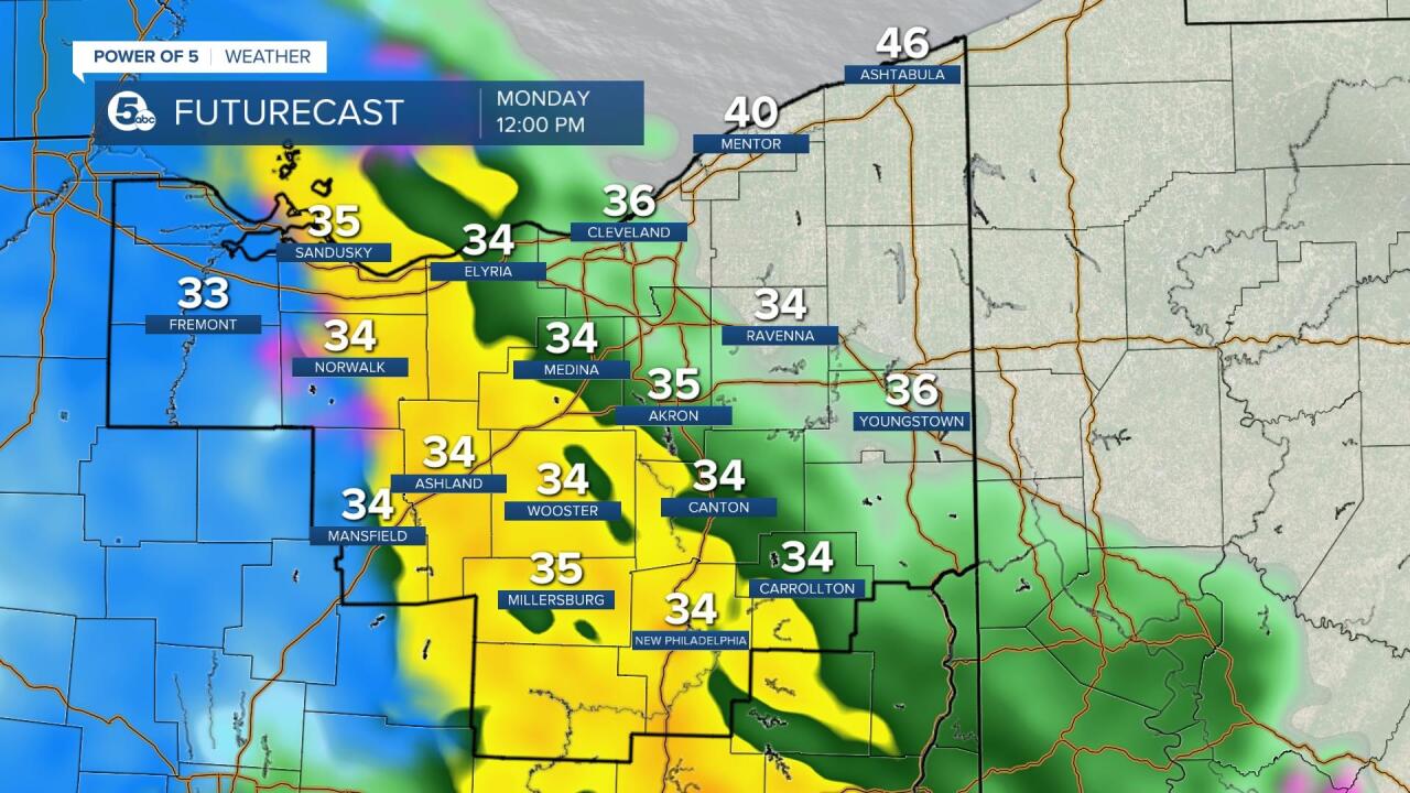
I will note, that my confidence is pretty low with this tricky forecast. However, I did not want you to be caught off guard. The issue with this forecast is the precipitation type. A couple of degrees will make a HUGE difference between minimal accumulation vs several inches. The data shows temperatures right on this edge. If the temperatures get closer to 40 degrees, the snow will not stick and impacts will be minor. BUT if the temperatures are in the mid-30s or colder, accumulating wet snow is likely.
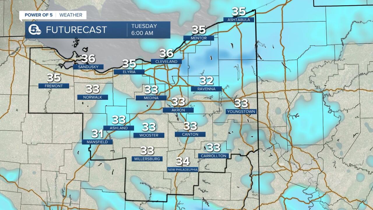
The morning drive looks quiet with more clouds and cold temperatures. However, by mid to late morning a new round of widespread precip moves in from the SW and spreads to the NE and continues until the evening. It will likely start as rain, but change over to snow with pockets of moderate to heavy snow. Heavier snow could overcome the warmer road temperatures and create slick or slushy conditions. Monday evening's drive could be slow. Showers look to become more scattered Monday night, but lake effect will continue into Tuesday resulting in additional accumulation, especially in the Snowbelt. Scroll through the images of Futurecast to get an idea about timing, precip. type and coverage.


It appears our eastern communities have the best chance for higher snowfall totals and lower amounts expected in areas south of Canton.
Since this is a complicated forecast, I highly encourage you to check back with the Power of 5 Weather Team on-air and online this evening and tomorrow morning.

Want the latest Power of 5 weather team updates wherever you go? Download the News 5 App free now: Apple|Android
Download the StormShield app for weather alerts on your iOS and Android device: Apple|Android
Click here to view our interactive radar.
Read and watch the latest Power of 5 forecast here.
Follow the News 5 Weather Team:
Mark Johnson: Facebook & Twitter
Remeisha Shade: Facebook & Twitter


