


CLEVELAND — Rain showers will arrive in several rounds Monday, which will elevate the risk for flooding for areas already soaked from overnight rain.

A cold front will fuel this afternoon's round of storms.
These will form quickly after lunchtime across western Ohio and slide east. The main timing for any strong to severe storms will be between 2-8 p.m. Also, watch out for a few additional flooding issues that may develop with more rain rolling in.
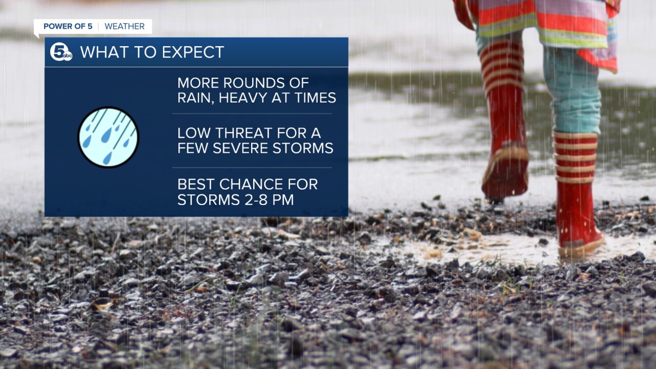
The strong storms could have straight-line damaging winds and even a small chance for an isolated tornado.

The main threat today is flooding, though. Many creeks and streams are already full, any extra rain will need time to run off.
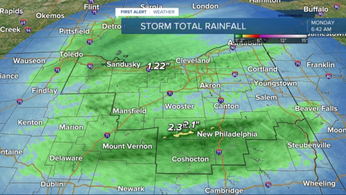
Remember, never drive through flooded roads.
Flooding kills more people every year than any other type of severe weather.
Want the latest Power of 5 weather team updates wherever you go? Download the News 5 App free now: Apple|Android
Download the StormShield app for weather alerts on your iOS and Android device: Apple|Android
Click here to view our interactive radar.
Read and watch the latest Power of 5 forecast here.
Follow the News 5 Weather Team:
Mark Johnson: Facebook & Twitter
Remeisha Shade: Facebook & Twitter
