


Do you remember what happened on October 21, 2021?? I sure do! It was an extremely active weather day for a few hours in the late afternoon and evening. It was considered a mini tornado outbreak across Northeast Ohio.
Eleven tornado warnings were issued in about a two-hour span. That was the most since 2005! In the end, eight tornadoes would be confirmed across portions of Northeast Ohio between 4:30 and 6:30 p.m. that afternoon, consisting of four EF-1s and four EF-0s.

On a personal note, I remember this event so well because I did the tornado cut-in for News 5. I was watching every radar scan and update like a hawk in the hopes to keep our viewers safe and informed. Additionally, one of the tornadoes touched down only houses away from my parent's home. That particular tornado produced quite a bit of damage to one house on their block. A year and a half later, that home is still getting work done to it to repair the damage it sustained. The tornado in Lake County was on the ground for only one minute and has affected a family for months after the storm. Thankfully, according to the National Weather Service, there were no injuries or fatalities from these storms or tornadoes.
Below is a list of the communities & counties affected by these eight tornadoes:
1 & 2. Medina County: An EF-1 tornado touched down in the southwest portion of Hinckley Township at 4:36 p.m. on Thursday. Peak winds were 97 mph, and the tornado had a path length of 2.5 miles and a path width of 50 yards. The tornado stayed on the ground until 4:42 pm. There were no fatalities or injuries. The tornado began near Turnstone Court and caused damage to a garage door and roof/siding damage to a home. The tornado moved east causing tree damage before ending in the Hinckley Reservation of the Cleveland Metropark System.

NWS Storm Survey also confirmed an EF-0 east of Seville and west of Wadsworth in Medina County. This tornado touched down just west of Rawiga Road/CR 133 and tracked northeast into a corn field leaving a path with spirals before lifting. The tornado was 50 yards and a 0.3 mile. Max wind speed was 80 mph.

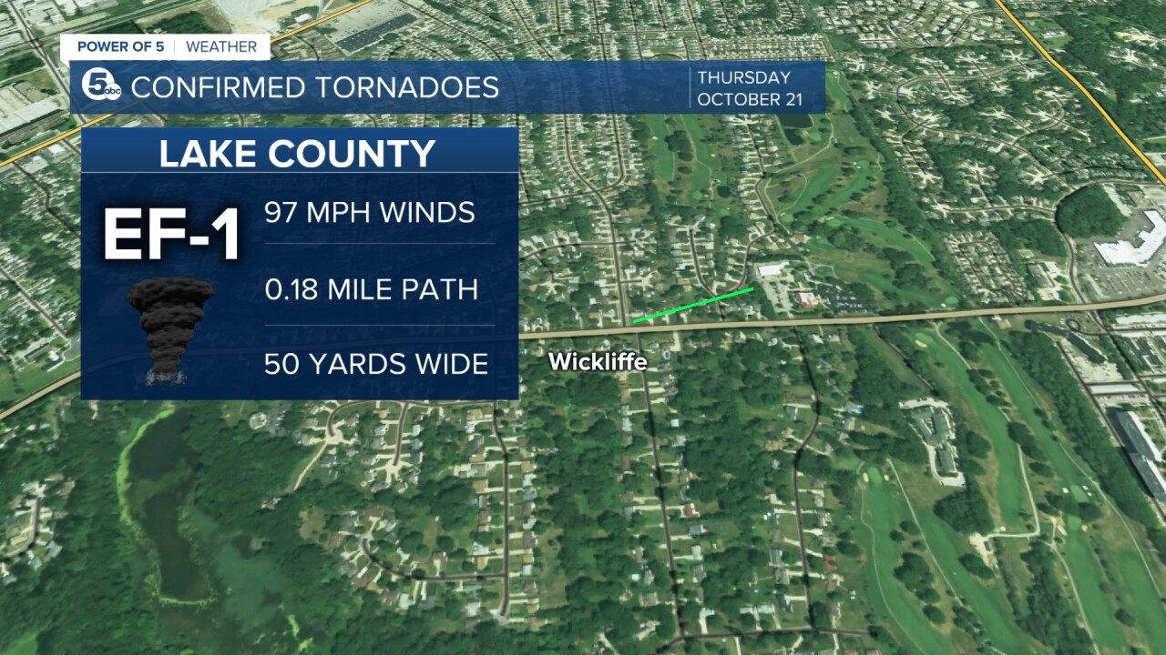
3. Lake County: A brief EF-1 tornado touched down near Wickliffe in Lake County at 4:49 pm on Thursday. Peak winds were 97 mph, and the tornado had a path length of 0.1751 miles. The tornado stayed on the ground for one minute. There were no fatalities or injuries. The tornado touched down on Briar Court and caused significant damage to one home as well as minor damage to the roofs and siding of other homes nearby. The tornado moved east onto Fairway Drive and several trees were snapped. The tornado continued into Pine Ridge County Club and caused additional tree damage before dissipating.
4. Stark County: A third EF-1 tornado touched down in Jackson Township in Stark County at 5:10 pm on Thursday. Peak winds were 110 mph with a path length of 2.9615 miles and a path width of 50 yards. The tornado stayed on the ground until 5:15 pm. There were no fatalities or injuries. The tornado initially touched down near North Park in Jackson Township and damaged trees, recreational buildings, and a large garage in the park. As the tornado continued east, it damaged a business along Wales Avenue NW. The tornado then moved into a neighborhood causing tree damage to Lake Cable. It crossed the lake and dissipated near I-77.

5. Summit County: A fourth tornado touched down near Hudson in Summit County. This was a weak EF-0 tornado that touched down at 5:08 pm on Thursday. Peak winds were 80 mph with a path length of 0.781 miles and a path width of 25 yards. The tornado stayed on the ground until 5:11 pm. There were no fatalities or injuries. The tornado touched down in Hudson SW of the intersection of SR 91 and Middleton Road. It continued NE towards The Country Club of Hudson and caused damage to trees. It then dissipated southeast of the golf course.

6 & 7. Trumbull County: An EF-1 tornado formed east of Mosquito Creek Lake and moved into the Mecca area on Thursday at about 6:15 p.m. The estimated peak wind was 104 mph, the path length was .6582 miles, and the path width was a maximum of 50 yards. The tornado hit several homes on Griffith and Edgewater drives, damaging several homes, with one suffering major damage to an attached garage. Several trees were snapped and uprooted in the path. The tornado dissipated at about 6:18 p.m. east of Philips Rice Road.
A very brief EF-0 tornado also touched down on Porter Drive in Johnston Township at about 6:20 p.m. The tornado had peak winds of 80 mph, a path length of .07 miles, and a maximum path width of 20 yards. The tornado caused tree damage across the area before lifting at about 6:21 p.m.

8. Portage County: A weak EF-0 Tornado touched down in Aurora on Thursday, October 21, 2021, around 5:21 pm. The estimated peak wind was 75 mph, the path length was .2178 miles, and the path width was a maximum of 25 yards. The tornado initially touched down west of a large 4-story building northwest of the intersection of Lena Drive and Page Road in Aurora. The tornado continued east toward the parking lot. The roof AC unit was blown over, some roof damage and tree limbs snapped and scattered across the parking lot.

Want the latest Power of 5 weather team updates wherever you go? Download the News 5 App free now: Apple|Android
Download the StormShield app for weather alerts on your iOS and Android device: Apple|Android
Click here to view our interactive radar.
Read and watch the latest Power of 5 forecast here.
Follow the News 5 Weather Team:
Mark Johnson: Facebook & Twitter
Trent Magill: Facebook & Twitter
